
BELOW: Today’s Weather Watch with Rick Gordon
Saturday’s Weather
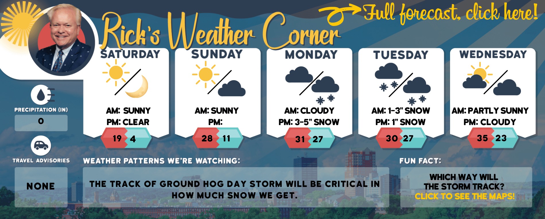
High-pressure crests over Manchester for the last Saturday of summer. The pattern turns unsettled tomorrow night into Monday as a stationary front forms over New Hampshire with low pressure tracking along the front.
5-Day Outlook Sept. 17-Sept. 21
Sunday: Some sun, warm & more humid. High 86 Winds: WSW 5-10 mph
Tuesday: Periods of sun & clouds with a few showers. High 74 Winds: NW 5-10 mph
Weather Patterns We’re Watching
Forecast for the White Mountains

The forecast for summits above 4,000 feet in Northern New Hampshire. Today: Partly sunny in the morning, then becoming mostly cloudy. Highs in the lower 50s. Northwest winds 15 to 25 mph with gusts up to 35 mph. Wind chill values are as low as 13 in the morning. The forecast for elevations between 2,500 and 4,000 feet in Northern New Hampshire. Today: Partly sunny in the morning, then becoming mostly cloudy. Areas of frost in the morning. Highs in the upper 50s. Northwest winds 10 to 15 mph.
Click Here for NH’s interactive Peak Foliage Map