
Weather Watch with Rick Gordon
Thursday’s Weather
High pressure brings quiet weather today before a large low-pressure system looks to impact New Hampshire tonight through Friday evening.
STORM WATCH
1) High Wind Watch for Friday expect powerful winds out of the southeast with gusts of 55-65 mph. The strong damaging winds can blow around loose objects and cause widespread power outages just before Christmas Eve day.
2) The snowmelt component could add between 0.5-1.25” of additional runoff. The rapid nature of the snowmelt and heavy rain on the frozen ground could lead to the rapid onset of flash flooding.
3) Travelers beware of a FLASH FREEZE as the temperature will drop 17 degrees in 3 hours as the arctic front moves through late Friday afternoon going from 48 at 4 PM Friday to 31 at 7 PM Friday with a snow squall. The last of the rain will have ended not long before and it will be a race against the clock to see whether winds can dry out the roads or if they remain wet and freeze up. The snow from the snow squall on top of the ice will make travel very difficult Friday evening.
4) The potential for coastal flooding with nearshore waves will just begin to develop Friday morning, potentially reaching 10 to 15 feet by the mid-morning high tide. Beach erosion and splash-over are likely.
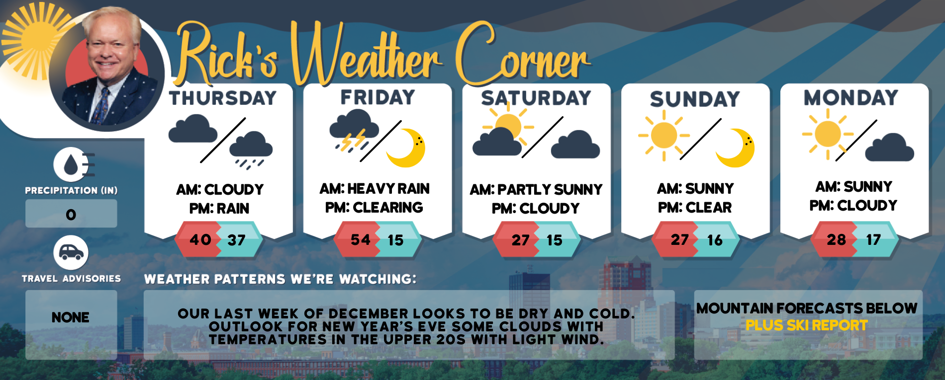
Daily Forecast for Dec. 22-Dec. 26, 2022
Weather Patterns We’re Watching
Our last week of December looks to be dry and cold. Outlook for New Year’s Eve some clouds with temperatures in the upper 20s with light wind.

Click for New Hampshire Ski & Boarding Report
White Mountains Weather
The forecast for summits above 4,000 feet in Northern New Hampshire:
Today –. Summits obscured. Highs in the mid-20s. South winds 20 to 30 mph. Wind chill values as low as 6 below.
The forecast for elevations between 2,500 and 4,000 feet in Northern New Hampshire:
Today – Summits obscured. Highs in the upper 20s. South winds around 15 mph with gusts up to 30 mph increasing to southeast around 25 mph with gusts up to 40 mph in the afternoon.