Weather Watch with Rick Gordon
Below: Watch your weather outlook via YouTube, delivered in two minutes.
Friday’s Weather
As low pressure crosses New England widespread rain and cooler conditions are expected today and early this evening along with highs in the upper 60s with more humidity.
5-Day Outlook, Aug. 25–29
Today: Cooler with some rain (.80″) and more humid. High 70 Winds: SSE10-15 mph
Tonight: Cloudy & humid with a few showers. Low 65 Winds: S 5-10 mph
Saturday: Some sun, warmer, & humid with a passing shower or thundershower. High 80 Winds: NW 5-10 mph
Saturday night: Partly cloudy and turning less humid late. Low 60 Winds: NW 5-10 mph
Sunday: Some sun & clouds with a passing shower. High 77 Winds: NW 5-10 mph
Sunday night: Partly cloudy. Low 56 Winds: Light & Variable
Monday: Partly to mostly sunny and nice. High 78 Winds: SSE 5-10 mph
Monday night: Clouding up with some showers late. Low 59 Winds: SE 5-10 mph
Tuesday: Lots of clouds with some showers. High 72 Winds: NE 5-15 mph
Tuesday night: Partly cloudy. Low 62 Winds: E 5-10 mph
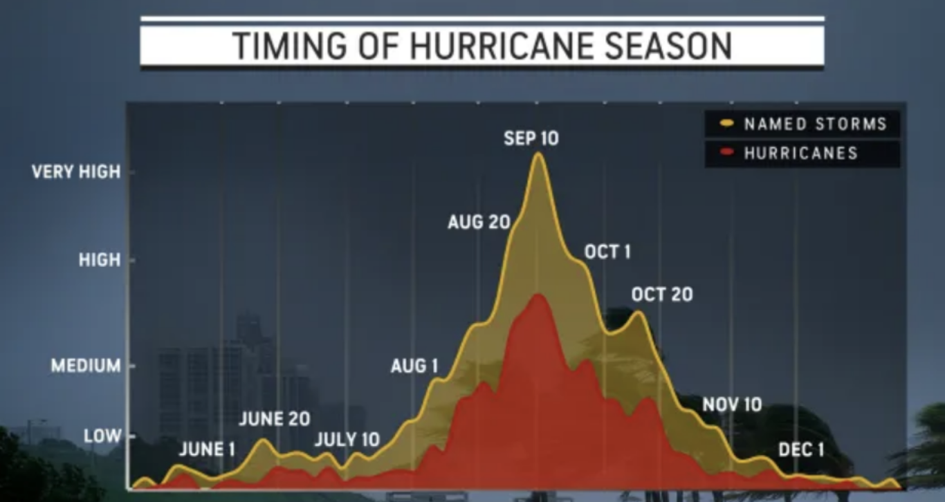
Hurricane Season
The historical average of tropical systems in the Atlantic trends upward at an exponential rate into the middle of September. This means that the chances of having a named system spinning somewhere in the Atlantic increase, along with the potential for having multiple named systems spinning simultaneously.
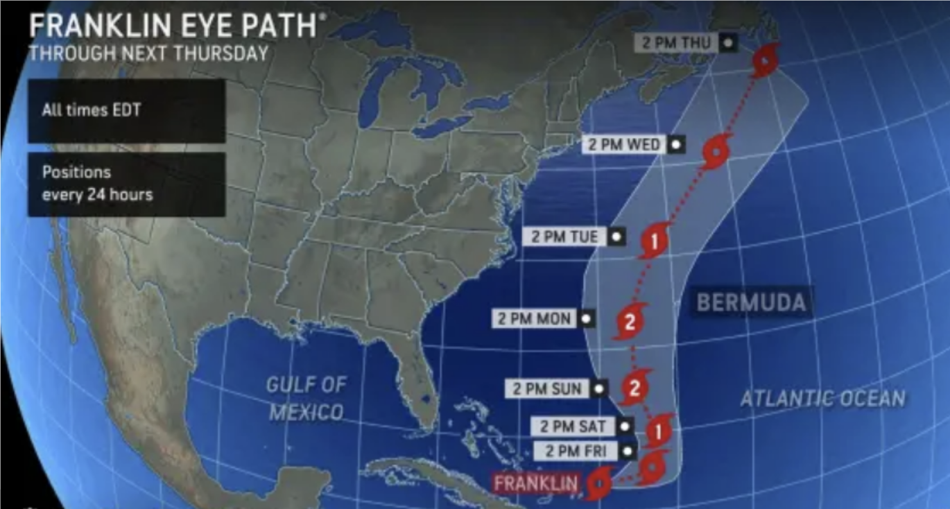
Franklin’s path and its potentially damaging winds will stay to the east of the United States next week. Impacts on the U.S. due to Franklin are likely to be limited to building seas offshore, turbulent surf, and an uptick in the number and strength of rip currents, especially from the Carolinas to Maine, during this weekend through the first part of next week.
Weather Patterns We’re Watching
This weekend into the last week of August temperatures will be below normal with above-normal precipitation.
 Hiking Report/White Mountains Weather
Elevations for summits above 4,000 feet in Northern New Hampshire Today: Showers with a chance of thunderstorms. Highs in the mid-50s. South winds around 40 mph with gusts up to 50 mph decreasing to around 30 mph with gusts up to 40 mph in the afternoon. Chance of rain near 100 percent.
Elevations between 2,500 and 4,000 feet in Northern New Hampshire Today: Showers. A chance of thunderstorms in the afternoon. Highs in the upper 50s. South winds around 30 mph with gusts up to 45 mph decreasing to around 20 mph with gusts up to 35 mph in the afternoon. Chance of rain near 100 percent.
BEACH FORECAST
Weather: Cloudy. Showers and a chance of thunderstorms.
UV Index: Low.
Thunderstorm Potential: Moderate. Implies that thunderstorms are possible.
High Temperature: In the upper 60s.
Winds: Southeast winds around 15 mph.
Surf Height: 4 to 5 feet.
Water Temperature: 64 degrees.
Rip Current Risk: Low
Tides Hampton Beach: High 7.3 feet (MLLW) 06:06 AM. Low 1.3 feet (MLLW) 12:22 PM.
 View on Lake Winnipiseogee (1828) by American painter Thomas Cole
Lake Forecast
East winds around 10 mph with gusts up to 20 mph. Waves around 2 feet. A chance of thunderstorms. Showers. Not as warm with highs in the mid-60s. Chance of rain near 100 percent. The lightning threat is moderate, which implies that thunderstorms are possible. The water temperature is 72 degrees.


