
Weather Watch with Rick Gordon
Below: Watch your weather outlook via YouTube, delivered in two minutes.
Thursday’s Weather
Today less humid and more seasonable weather with highs in the mid-70s lasting into Friday. Increasing surf and rip currents are likely to begin today and continue into the weekend due to Hurricane Lee.

5-Day Outlook, Sept. 14–18
Today: Mostly sunny and less humid. High 75 Winds: NW 5-10 mph
Tonight: Clear & comfortable. Low 53 Winds: NW 5-10 mph
Friday: Cool & breezy with sun through high clouds. High Around 70 Winds: NNW 10-15+ mph
Friday night: Clouding up with some rain late with wind picking up. Low 59 Winds: NNE 15-25 mph
Saturday: Windy and rainy (.50-1″) from Hurricane Lee; the greatest impact along the coast. High 67 Winds: NNW 20-30 with some gusts to 48 mph
Saturday night: Early rain (.25″) with some clearing late. Low 58 Winds: NW 10-25 with gusts to 40 mph
Sunday: Sunny, breezy and warmer. High 77 Winds: NW 10-15+
Sunday night: Partly cloudy. Low 56 Winds: Light & Variable
Monday: Partly to mostly sunny & nice. High 75 Winds: W 5-10 mph
Monday night: Clear & comfortably cool. Low 55 Winds: Light & Variable
Hurricane Lee Update
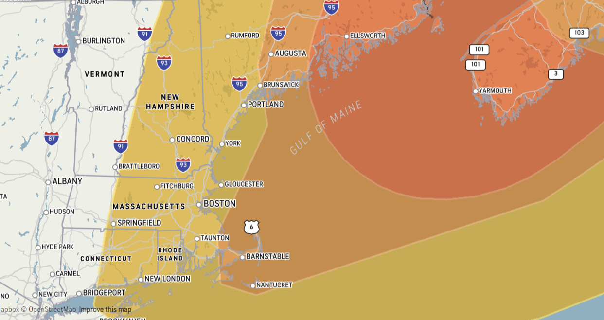
The level of risk is due to high winds, flooding rain, beach erosion, and tornado potential for an active tropical system.
Lee’s forecasted impacts on Hampton Beach
- START 5 AM Saturday, 9/16
- END 10 PM Saturday, 9/16
- Peak Sustained Winds 40 mph
- Peak Wind Gusts 50 mph
- Total Rainfall 1-2 inches
Building offshore swells, coastal wave action, beach erosion, and rip currents from Friday into Saturday.
Lee’s forecasted impacts on Manchester
- START 5 AM Saturday, 9/16
- END 10 PM Saturday, 9/16
- Peak Sustained Winds 24 mph
- Peak Wind Gusts 48 mph
- Total Rainfall .50-1″ in
Weather Patterns We’re Watching
Hurricane Lee’s direct impacts Saturday into Sunday morning will be rough surf, rip currents, beach erosion, and gusts to 50 mph along coastal New Hampshire.
 Hiking Report/White Mountains Weather
Elevations for summits above 4,000 feet in Northern New Hampshire Today: Summits obscured. A chance of showers in the morning. Highs in the lower 50s. West winds 20 to 30 mph. Chance of rain 40 percent.
Elevations between 2,500 and 4,000 feet in Northern New Hampshire Today: Summits obscured in the morning, then becoming mostly cloudy. A chance of showers in the morning. Highs in the upper 50s. West winds around 15 mph with gusts up to 30 mph increasing to northwest around 25 mph with gusts up to 40 mph in the afternoon. Chance of rain 50 percent.

BEACH FORECAST
Weather: Mostly sunny.
UV Index: High.
Thunderstorm Potential: None.
High Temperature: In the low-70s.
Winds: Northwest winds around 5 mph.
Surf Height: Around 3 feet.
Water Temperature: 67 degrees.
Rip Current Risk: Low.
Tides Hampton Beach: Low 0.4 feet (MLLW) 06:04 AM. High 8.2 feet (MLLW) 11:56 AM.
 View on Lake Winnipiseogee (1828) by American painter Thomas Cole
Lake Forecast
West winds around 10 mph. Waves around 2 feet. Mostly sunny. A slight chance of showers in the morning. Patchy fog in the morning. Highs around 70. Chance of rain 20 percent. Thunderstorms are not forecast for this period. The water temperature is 73 degrees.