
Weather Watch with Rick Gordon
Below: Watch your weather outlook via YouTube, delivered in two minutes.
Thursday’s Weather
Today some sun & clouds with above-normal temperatures in the low 40s.
Weather Alert
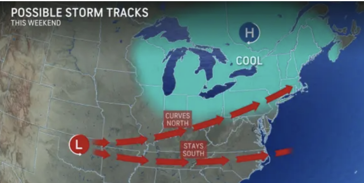
The chance of snow is increasing from late Saturday night into Sunday. The current track is curving north which means we’re likely to see heavier amounts of snow (6-12″).
5-Day Outlook, Jan. 4-8

Today: Cloudy to partly sunny. High 42 Winds: WNW 10-15 mph
Tonight: Clear, breezy, & colder. Low 19 (feel like 4) Winds: NW 10-15+ mph
Friday: Mostly sunny & cold. High 34 (feel like 24) Winds: WNW 10-15 mph
Friday night: Clear to partly cloudy & cold. Low 24 Winds: W 5-10 mph
Saturday: Partly to mostly cloudy. High: 34 Winds: NE 5-10 mph
Saturday night: Cloudy with periods of snow (3-5″) late. Low 25 Winds: NE 10-15 mph
Sunday: Morning snow (3-5″) possibly heavy at times with afternoon snow showers & windy. High 30 (feel like 25) Winds: N 10-15 mph
Sunday night: Early flurries with some clearing late. Low 17 Winds: NNW 5-10 mph
Monday: Mostly sunny, with a high near 36.
Monday Night: Partly cloudy, with a low around 20.
Weather Patterns We’re Watching
Our first nor’easter with moderate to heavy snow Saturday night into Sunday.
 Hiking Report/White Mountains Weather
Elevations for summits above 4,000 feet in Northern New Hampshire Today: Mostly sunny. Highs in the upper 20s. Northwest winds 10 to 20 mph with gusts up to 55 mph.
Elevations between 2,500 and 4,000 feet in Northern New Hampshire Today: Mostly cloudy in the morning, then becoming partly sunny. Highs in the upper 20s. West winds 10 to 15 mph with gusts up to 35 mph.

Check for opening dates for Ski NH resorts.