Rick Gordon’s Weather Watch
Follow our YouTube channel here.
Today’s Weather
Bundle up, the coldest air of the season is upon us! We’re looking at mostly sunny skies, but don’t let that fool you—it’s going to be very cold out there, with a high of just 19 degrees. Expect gentle breezes from the southwest at 5 to 10 mph, adding a little chill to the air. Perfect weather for a cozy day indoors or a brisk stroll outside!
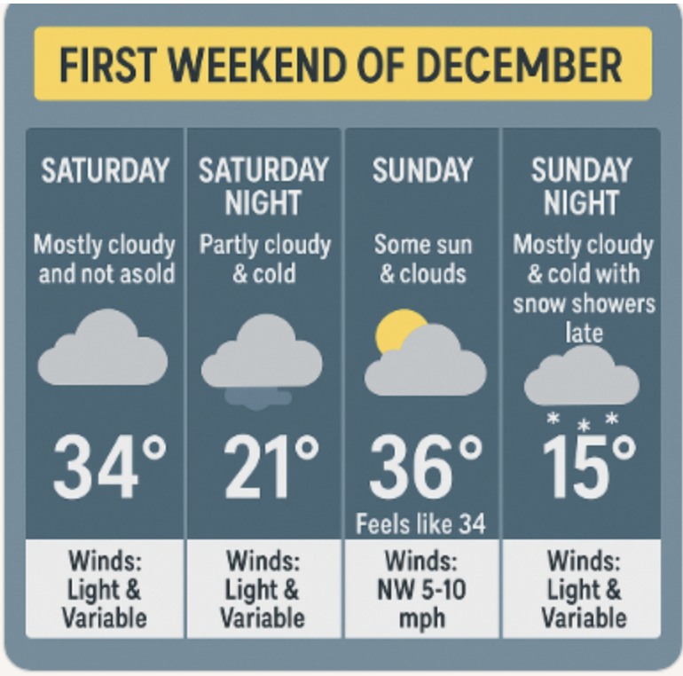
Forecast for first weekend of December
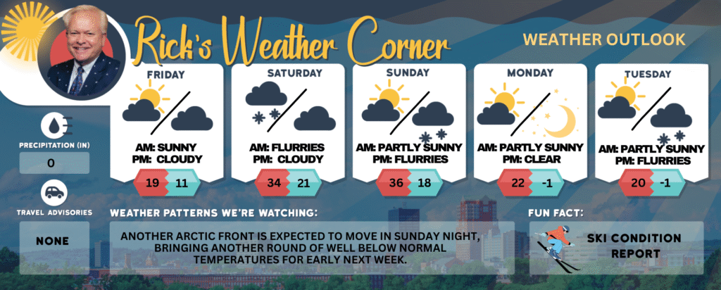
Today: Mostly sunny & very cold. High 19 Winds: SW 5-10 mph
Tonight: Partly to mostly cloudy & frigid. Low 11 Winds: Light & Variable
Saturday: Mostly cloudy and not as cold. High 34 Winds: Light & Variable
Saturday night: Partly cloudy & cold. Low 21 Winds: Light & Variable
Sunday: Some sun & clouds. High 36 (feel like 34) Winds: NW 5-10 mph
Sunday night: Mostly cloudy & cold with snow showers late. Low 15 Winds: Light & Variable
Monday: Mostly sunny, breezy, & very cold. High 22 (feel like 9) Winds: NW 10-15+ mph
Monday night: Mainly clear & frigid. Low Around -1 Winds: Light & Variable
Tuesday: Early sun with afternoon clouds with light snow (1″). High 26 Winds: SW 5-10 mph
Tuesday night: Mostly cloudy with evening flurries. Low 20 Winds: Light & Variable
Weather Patterns We’re Watching
Another Arctic front is expected to move in Sunday night, bringing another round of well below normal temperatures for early next week.
Get Out!
Elevations for summits above 4,000 feet in Northern New Hampshire today: Partly sunny with highs around 7 above. West winds will range from 15 to 25 mph, increasing to 30 to 40 mph at elevations above 5,000 feet. Wind chill values could drop as low as 47 below.
Elevations between 2,500 and 4,000 feet in Northern New Hampshire today: Partly sunny in the morning, shifting to mostly cloudy later on. Highs near 10 above, with west winds at 10 to 15 mph and gusts reaching up to 45 mph.