Rick Gordon’s Weather Watch
Follow our YouTube channel here.
Weather Watch
Expect colder temperatures today, with intermittent light snow and flurries throughout the morning. Accumulation from last night and this morning’s snowfall is predicted to total between 3 to 5 inches. As the day progresses, conditions will shift to areas of drizzle during the afternoon. The high temperature is expected to reach 34 degrees, though it will feel more like 29 degrees due to wind chill. Winds will be coming from the northeast at a gentle speed of 5 to 10 miles per hour. Please be cautious while traveling in slippery conditions.
Weekend Outlook
🌧️ Saturday A messy start with a bit of sleet and freezing rain in the morning. The rest of the day turns cloudy and not as cold. High: 49° (feels like 43°) Wind: S 5–15 mph
🕑 Saturday Night Don’t forget to set clocks ahead one hour before bed — Daylight Saving Time begins! Cloudy and mild with showers developing late. Low: 45° Wind: SW 5–10 mph
🌤️ Sunday Some sunshine and mild for early March. High: 56° Wind: W 5–10 mph
🌙 Sunday Night Mainly clear and still on the mild side. Low: 35° Wind: SSW 5–10 mph
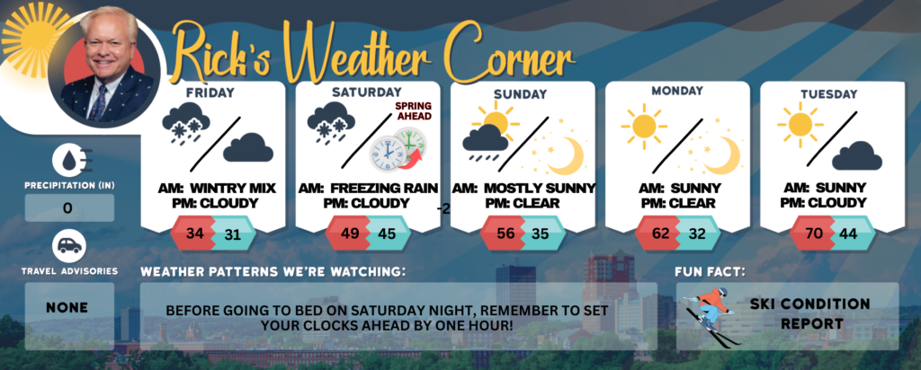
Friday: Colder; intermittent light snow and flurries in the morning followed by areas of drizzle in the afternoon; storm total 3-5″. High 34 (feel like 29) Winds: NE 5-10 mph
Friday night: Some clouds & fog. Low 31 Winds: Light & Variable
Saturday: A bit of sleet and freezing rain in the morning; otherwise, cloudy and not as cold. High 49 (feel like 43) Winds: S 5-15 mph
Saturday night (Before going to bed on Saturday night, remember to set your clocks ahead by one hour!): Cloudy & mild with some showers late. Low 45 Winds: SW 5-10 mph
Sunday: Some sun & mild. High 56 Winds: W 5-10 mph
Sunday night: Mainly clear & mild. Low 35 Winds: SSW 5-10 mph
Monday: Sunny, nice, and warm!!! High 62 Winds: SW 5-10 mph
Monday night: Mainly clear and mild. Low 42 Winds: SW 5-10 mph
Tuesday: Mostly sunny, nice, and very warm. High Near 70 Winds: WSW 5-10 MPH
Tuesday night: Partly cloudy & mild with some fog. Low 44 Winds: Light & Variable
Weather Patterns We’re Watching
Before going to bed on Saturday night, remember to set your clocks ahead by one hour!
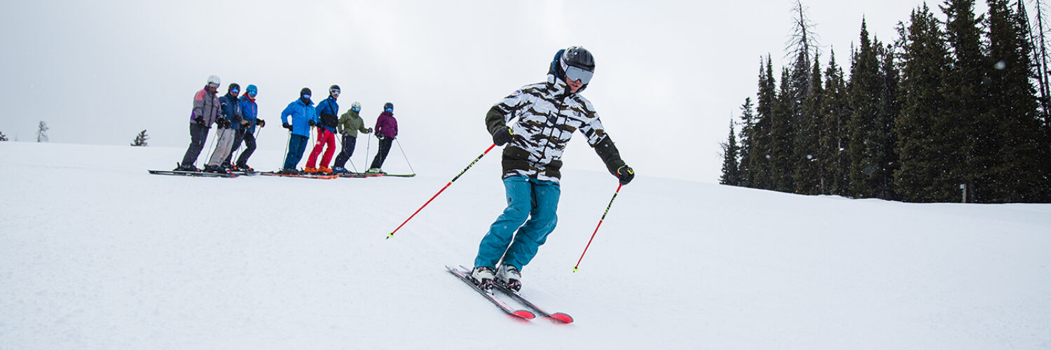
Get Out!
Elevations for summits above 4,000 feet in Northern New Hampshire today: Summits will be obscured with a chance of morning snow. Highs will reach the upper 20s, with south winds at 10 to 20 mph and gusts up to 40 mph. There’s a 50 percent chance of snow.
Elevations between 2,500 and 4,000 feet in Northern New Hampshire today: Summits will be hidden by clouds, with highs in the upper 20s. Southeast winds will reach up to 10 mph, with gusts as strong as 30 mph.