
Weather Watch with Rick Gordon
Below: Watch your weather outlook via YouTube, delivered in two minutes.
Monday’s Weather

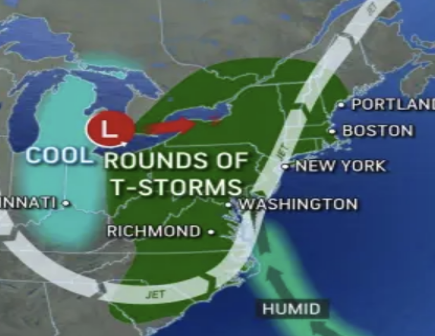
Rounds of Thunderstorms
Rounds of showers and thunderstorms all week with locally heavy rain possible in any storms that develop. This will bring an increased potential for flash flooding in isolated locations, particularly in Northern New Hampshire.
5-Day Forecast June 26-June 30
Weather Patterns We’re Watching
The muggy conditions with hit-or-miss thunderstorms will hold on for the first full week of summer.
 Hiking Report/White Mountains Weather
Elevations for summits above 4000 feet in Northern New Hampshire Today: Summits in and out of clouds in the morning, then becoming obscured in clouds. Showers and thunderstorms are likely. Some thunderstorms may produce heavy rainfall. Highs around 70. Southeast winds 25 to 30 mph.
Elevations between 2,500 and 4,000 feet in Northern New Hampshire Today: Summits obscured in clouds. Showers with thunderstorms are likely. Some thunderstorms may produce heavy rainfall. Highs in the lower 70s. Southeast winds 10 to 15 mph.

BEACH FORECAST
Weather: Mostly cloudy. Patchy fog. Showers are likely and a chance of thunderstorms.
UV Index: Low.
Thunderstorm Potential: Moderate. Implies that thunderstorms are possible.
High Temperature: In the upper 60s.
Winds: East winds 5 to 10 mph.
Surf Height: Around 2 feet.
Water Temperature: 62 degrees.
Rip Current Risk: Low.
Tides Hampton Beach: Low 1.1 feet (MLLW) 12:07 PM.
 View on Lake Winnipiseogee (1828) by American painter Thomas Cole