Rick Gordon’s Weather Watch
Follow our YouTube channel here.
Today’s Weather
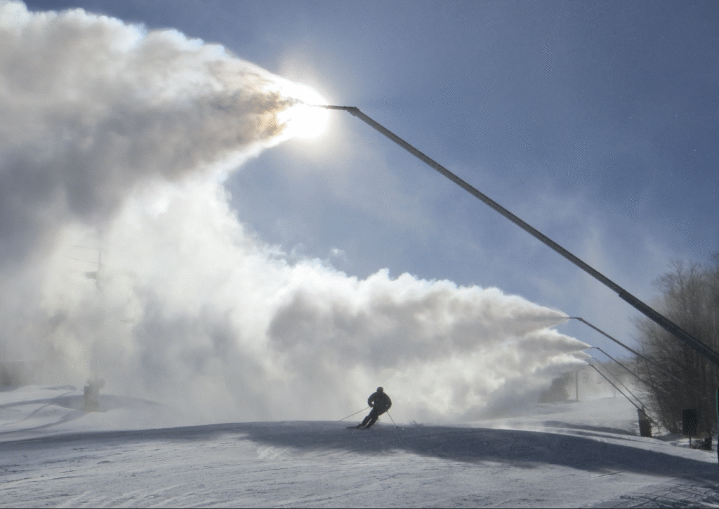
Expect bright sunshine combined with a brisk breeze but bundle up—it’s going to be very cold! The high will reach 25°, though it will feel more like 12°. Winds will be strong from the WNW at speeds of 10-20+ mph, so stay warm out there!
The Chill Before the Warm
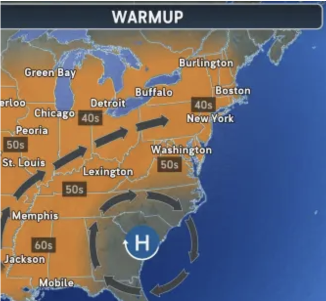
A break from the deep freeze is coming as it will be warmer later this week. How long will the break last, and could it ruin the chances of having a white Christmas? The start of December is usually cold due to the polar vortex. So far this month, New England has recorded average temperatures about 10 to 15 degrees below normal.

As the week goes on, the cold will ease up, with many places seeing temperatures rise above the usual 40-degree average from Wednesday to Friday. With the warmup, it could dash the hopes for many of a white Christmas as current snow cover on the ground may melt and not survive to Christmas Day. But some long-range models are calling for some snow on Christmas Day.
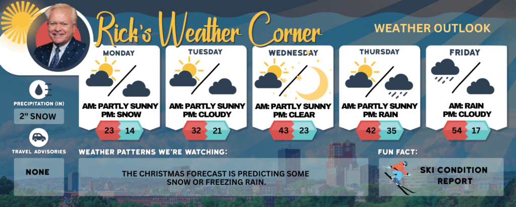
Today: Some sun, breezy, and very cold. High 23 (feel like 10) Winds: WNW 10-20+ mph
Tonight: Partly cloudy and cold. Low 14 Winds: Light & Variable
Tuesday: Mostly sunny and not as cold. High 32 Winds: W 5-10 mph
Tuesday night: Partly cloudy & cold. Low 21 Winds: Light & Variable
Wednesday: Milder with some sun & clouds. High 43 (feel like 36) Winds: SW 10-15 mph
Wednesday night: Mainly clear. Low 23 Winds: W 5-10 mph
Thursday: Some sun & clouds. High 42 Winds: S 5-10 mph
Thursday night: Mostly cloudy & breezy with rain late. Low 36 Winds: S 10-15 mph
Friday: Very mild & windy with periods of rain (1″). High 54 Winds: WSW 15-25+ mph
Friday night: Partly cloudy, breezy, & colder. Low 17 (feel like 10) Winds: NW 10-15 mph
Weather Patterns We’re Watching
The Christmas forecast is predicting some snow or freezing rain.
Get Out!
Elevations for summits above 4,000 feet in Northern New Hampshire today: Summits drifting in and out of the clouds with highs near 5 degrees. Northwest winds around 40 mph easing to about 30 mph by afternoon. Above 5,000 feet, northwest winds near 60 mph dropping to around 50 mph later in the day. Wind chills could plunge to 43 below.
Elevations between 2,500 and 4,000 feet in Northern New Hampshire today: In the morning, summits will be hidden, later shifting in and out of clouds. Highs will be near 9°F, with northwest winds at 15 to 25 mph and gusts up to 60 mph. Wind chills could drop as low as 30°F below zero.