
Weather Watch with Rick Gordon
Below: Watch your weather outlook via YouTube, delivered in two minutes.
Monday’s Weather
Mainly cloudy and cooler with very windy conditions with winds between 25-35 mph with winds occasionally gusting over 50 mph.
WIND ADVISORY IN EFFECT FROM 8 AM MONDAY TO 2 AM TUESDAY.
WHAT: Northwest winds 20 to 30 mph with gusts up to 50 mph expected. WHERE: Central, northern, and southern New Hampshire.
WHEN: From 8 AM Monday to 2 AM Tuesday.
IMPACTS: Gusty winds will blow around unsecured objects. Tree limbs could be blown down and a few power outages may result.
ADDITIONAL DETAILS: Winds will steadily increase through the morning, peaking during the afternoon and evening across the area.
PRECAUTIONARY/PREPAREDNESS ACTIONS: Winds this strong can make driving difficult, especially for high-profile vehicles. Use extra caution.

5-Day Outlook, March 11-15
Weather Alert
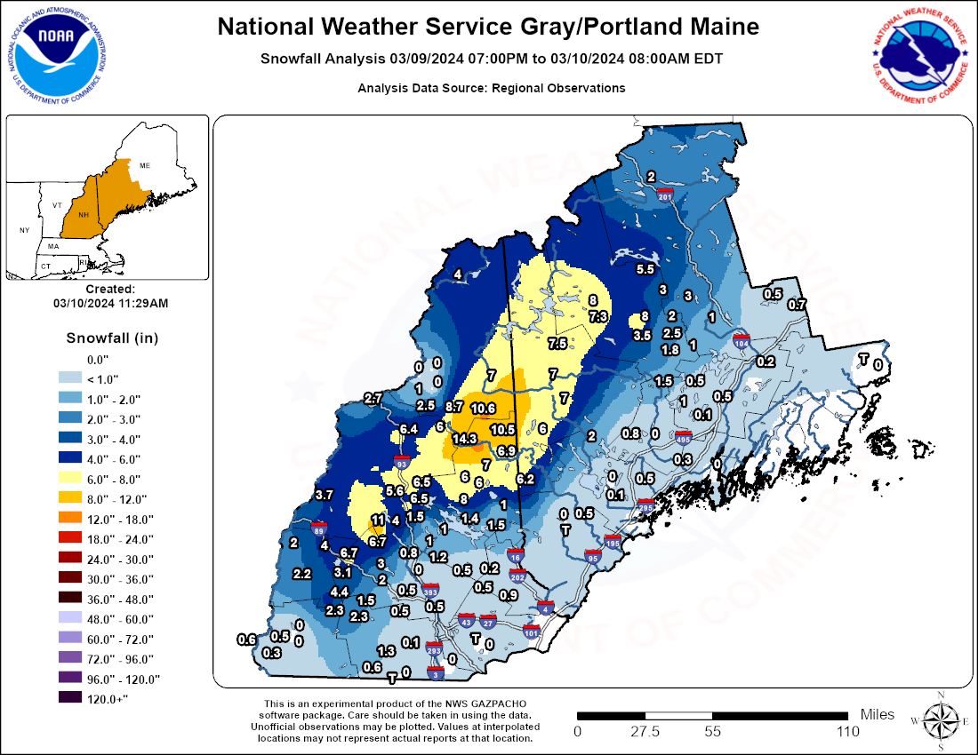
Southern New Hampshire had mainly rain Saturday night into Sunday morning with 1-1.50″. Notable snowfall was reported across New Hampshire and Maine. Here’s a look at how much snow fell Saturday night into Sunday morning.
Weather Patterns We’re Watching
 Hiking Report/White Mountains Weather
Elevations for summits above 4,000 feet in Northern New Hampshire Today: Summits obscured. Snow showers are likely. Highs around 20. Northwest winds around 50 mph increasing to around 60 mph in the afternoon. At elevations above 5000 feet, northwest winds 65 to 75 mph. The chance of snow is 60 percent. Wind chill values as low as 12 below.
Elevations between 2,500 and 4,000 feet in Northern New Hampshire Today: Summits obscured. Snow showers are likely. Highs in the mid-20s. Northwest winds around 35 mph increasing to around 45 mph in the afternoon. Gusts up to 90 mph. The chance of snow is 70 percent. Wind chill values as low as 10 below.
