
Rick Gordon’s Weather Watch
Follow our YouTube channel here.
Today’s Outlook
Memorial Day: Start your day with morning rain (.25″), but don’t worry—sunshine will break through later! Expect a pleasant high of 72°. Enjoy gentle north winds at 5-15 mph!
Warmer Days Ahead
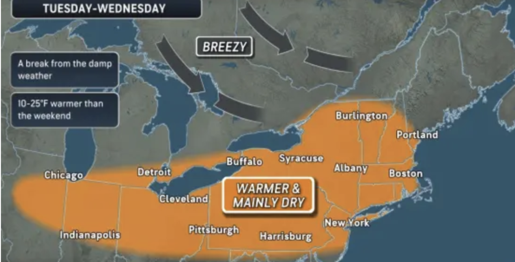
After a holiday weekend with temperatures lingering in the 50s, a summer-like warmth is expected for tomorrow and Wednesday, with highs reaching the lower 80s. This transition will prompt many people to turn their air conditioners back on, having potentially relied on their furnaces over the weekend. However, temperatures will not rise as much as they did last week, when some areas set May temperature records in the 90s.
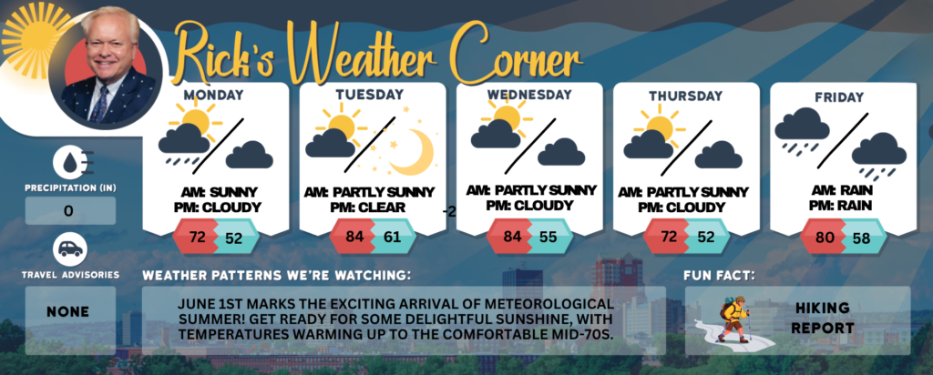
Memorial Day: Warmer; periods of rain (.25″) in the morning, with some sun expected to shine later in the day. High 72 Winds: N 5-15 mph
Monday night: Partly cloudy & cool. Low 52 Winds: Light & Variable
Tuesday: Mostly sunny & summer-like. High 84 Winds: W 5-10 mph
Tuesday night: Mainly clear & mild. Low 61 Winds: WSW 5-10 mph
Wednesday: Very warm with some sun & clouds. High 84 Winds: WNW 10-15 mph
Wednesday night: Some clouds & mild. Low 55 Winds: NW 5-10 mph
Thursday: Some sun & nice. High 74 Winds: NNW 10-15 mph
Thursday night: Partly to mostly cloudy. Low 52 Winds: NNW 5-10 mph
Friday: Mainly cloudy & cool with some afternoon showers. High 70 Winds: NNW 10-15 mph
Friday night: Showers early some partial clearing late. Low 49 Winds: NNE 5-10 mph
Weather Patterns We’re Watching
June 1st marks the exciting arrival of Meteorological Summer! Get ready for some delightful sunshine, with temperatures warming up to the comfortable mid-70s.
Get Out!
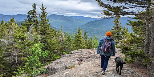
Take a Hike
Elevations for summits above 4,000 feet in Northern New Hampshire Today: Morning showers are expected, followed by a chance of showers in the afternoon. High temperatures will be in the mid-50s, except around 50°F at elevations above 5,000 feet. South winds will be around 20 mph, shifting to the northwest in the afternoon, with gusts reaching up to 40 mph. The chance of rain is nearly 100 percent. Elevations between 2,500 and 4,000 feet in Northern New Hampshire Today: Showers are expected, with highs reaching the upper 50s. Southeast winds will be around 15 mph, shifting to the west in the afternoon, with gusts up to 35 mph. There is a near 100 percent chance of rain.
Hit the Beach
Hampton Beach – Today: Cloudy until 4 PM, then partly sunny. Patchy fog. Morning Showers. Thunderstorm Potential: None. High Temperature: In the mid 60s. Winds: East winds around 5 mph, becoming west in the afternoon. Surf Height: Around 4 feet. Water Temperature: 52 degrees. According to the US Coast Guard, when the water temperature drops below 60 degrees, a submerged person can lose dexterity within minutes, making it difficult to perform simple tasks such as buckling a life jacket or operating a radio. Rip Current Risk: Low. Tides: Hampton Beach: High 8.3 feet (MLLW) 07:32 AM. Low 0.6 feet (MLLW) 02:04 PM.
Jump in a Lake
Weirs Beach Today: Northeast winds will be around 10 mph, shifting to the west in the afternoon. Expect waves of about 2 feet. Showers are likely in the morning, transitioning to partly sunny skies with a chance of additional showers in the afternoon. It will be much warmer, with highs reaching the upper 60s. The chance of rain is nearly 100 percent. The water temperature is currently 56 degrees. According to the U.S. Coast Guard, when the water temperature falls below 60 degrees, a person submerged in the water could lose dexterity within minutes, making it difficult to perform simple tasks such as buckling a life jacket or operating a radio.