Rick Gordon’s Weather Watch
Follow our YouTube channel here.
Weather Watch
The weather is expected to be cold, with intermittent light snow accumulating between 2 and 4 inches, accompanied by blowing and drifting snow. The anticipated high temperature is 19 degrees, with a wind chill that may make it feel like 9 degrees. Winds will be coming from the north at speeds of 10 to 15 miles per hour or higher.

WINTER STORM WARNING REMAINS IN EFFECT UNTIL 7 PM MONDAY
Snowfall totals are expected to range from 12 to 18 inches, with some spots, particularly along coastal southwest Maine and southern & southeast New Hampshire, possibly seeing up to around 2 feet. Strong winds will blow and pile snow into drifts several feet high, making some streets and highways impassable. The frigid air moving in after the storm means there will be little to no natural melting for days. Our next day above the melting point will be next Tuesday. The coldest part of the week will probably be from Wednesday night to Thursday morning, with temperatures dipping close to zero.
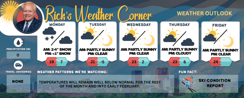
Today: Cold with periods of light snow (2-4″) with blowing & drifting snow. High 19 (feel like 11) Winds: N 5-15+ mph
Tonight: Intermittent light snow and flurries in the evening, accumulating a coating to an inch; otherwise, clearing and cold; storm total snowfall 12-18 inches. Low 7 (feel like -5) Winds: NW 10-15 mph
Tuesday: Cold with some sun & clouds. High 21 (feel like 11) Winds: WNW 5-15 mph
Tuesday night: Clear to partly cloudy & frigid. Low -5 Winds: W 5-10 mph
Wednesday: Cold with some sun & clouds. High 23 (feel like 11) Winds: WNW 10-15+ mph
Wednesday night: Mainly clear & frigid. Low 2 (feel like -6) Winds: WNW 5-10 mph
Thursday: Cold with some sun & clouds. High 23 (feel like 15) Winds: NW 10-15 mph
Thursday night: Some clouds, breezy, and very cold. Low 6 (feel like -5) Winds: NW 10-15 mph
Friday: Mainly sunny, breezy, and cold. High 24 (feel like 5) Winds: NW 10-15 mph
Friday night: Clear to partly cloudy and very cold. Low 7 (feel like -13) Winds: NW 10-15 mph
Weather Patterns We’re Watching
Temperatures will remain well below normal for the rest of the month and into early February.
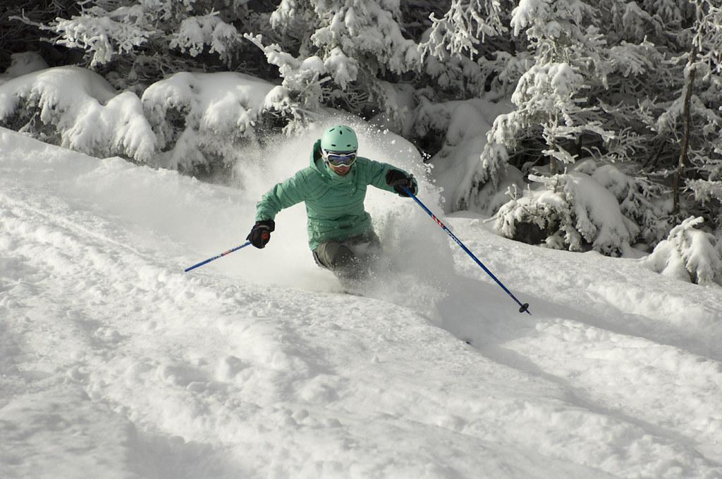
Get Out!
Elevations for summits above 4,000 feet in Northern New Hampshire today: Snow with highs ranging from 4 to 14 degrees above. East winds around 30 mph, shifting to the northeast at about 20 mph in the afternoon, with gusts reaching up to 65 mph. Nearly a 100 percent chance of snow, and wind chills dropping as low as 33 degrees below.
Elevations between 2,500 and 4,000 feet in Northern New Hampshire today: Snow, with highs ranging from 6 to 16 degrees above zero. East winds at 10 to 15 mph, gusting up to 45 mph. Nearly a 100 percent chance of snow.