
Rick Gordon’s Weather Watch
Follow our YouTube channel here.
Today’s Weather
As we start the last full week of July, get ready for a delightful day filled with plenty of sunshine! Enjoy the gentle breeze and cool temperatures, which make the air feel pleasantly refreshing due to lower humidity levels. Expect a high of 77 degrees, with northwest winds whipping through at 15-20+ mph. It’s the perfect weather to step outside and soak it all in!
5-Day Outlook
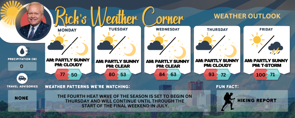
Today: Lots of sunshine, breezy, and cool with less humidity. High 77 Winds: NW 15-20+ mph
Tonight: Clear & chilly. Low Around 50 Winds: NNW 5-15 mph Tuesday: Predominantly sunny and comfortable with minimal humidity. High 80 Winds: NW 5-10 mph
Tuesday night: Clear & cool. Low 53 Winds: Light & Variable Wednesday: Some sun & comfortable. High 84 Winds: WSW 5-10 mph
Wednesday night: Clear to partly cloudy. Low 63 Winds: S 5-10 mph
Thursday: Hazy sun, breezy, hot, and more humid. High 93 (feel like 96) Winds: SW 10-15+ mph
Thursday night: Partly cloudy, warm, and humid. Low 72 (feel like 74) Winds: SW 5-10 mph
Friday: Hazy, very hot, and humid with afternoon thunderstorms. High 100 (feel like 103) Winds: WSW 5-15 mph
Friday night: Humid and warm with scattered thunderstorms expected early, followed by clearing later. Low 71 (feel like 74) Winds: NW 5-10 mph
July Heat on the Horizon
For many who have grown weary of the prolonged days of high humidity and soaring temperatures in New Hampshire, a brief respite is expected at the beginning of the week. However, the fourth heat wave of the season is on the horizon to arrive on Thursday and last through the start of the final weekend of July.
Weather Patterns We’re Watching
The fourth heat wave of the season is set to begin on Thursday and will continue until through the start of the final weekend in July.
Get Out!
Take a Hike: Summits above 4,000 feet: Initially, summits will be intermittently cloud-covered in morning, gradually transitioning to partly sunny conditions. Temperatures will reach highs in the lower 50s, except for elevations above 5,000 feet, where highs will be in the mid-40s. Northwest winds are expected at 25 to 35 mph, with gusts reaching up to 60 mph. Elevations between 2,500 and 4,000 feet: Summits will be obscured in the morning, transitioning to intermittent visibility as clouds move in and out. Temperatures will reach highs in the upper 50s. Northwest winds will range from 15 to 25 mph, with gusts reaching up to 50 mph.
Hit the Beach Hampton & Rye Beach
Weather: Sunny.
UV Index: Very high.
Thunderstorm Potential: None.
High Temperature: In the mid 70s.
Winds: Northwest winds around 10 mph.
Surf Height: Around 2 feet.
Water Temperature: 66 degrees.
Rip Tide Current Risk: Low.
Tides Hampton Beach: High 7.9 feet (MLLW) 08:43 AM. Low 0.7 feet (MLLW) 02:54 PM..
Jump in a Lake Weirs Beach:
Northwest winds at approximately 15 mph, with gusts reaching up to 25 mph. Waves are less than 1 foot at the north end of the lake and around 1 foot at the south end. The weather is sunny, not as warm, and less humid, with high temperatures near 70 degrees. The water temperature is 75 degrees. The water will be warmer than the air temperature!!