
Rick Gordon’s Weather Watch
Follow our YouTube channel here.
Today’s Weather
Prepare for predominantly sunny and muggy conditions, with extremely high temperatures reaching 94 degrees (feeling like 98). Isolated thunderstorms are expected in the afternoon, so exercise caution if you plan to engage in strenuous outdoor activities. Winds will be blowing from the southwest at 5-15 mph. Stay safe!
Heat Advisory in Effect until 8 p.m.
WHAT: Heat index values in the upper 90s expected.
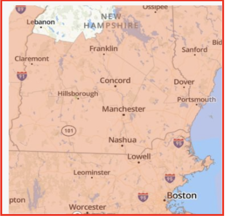
WHERE: Central, northern, and southern New Hampshire.
WHEN: Until 8 PM tonight.
IMPACTS: Hot temperatures and high humidity may cause heat illnesses.
PRECAUTIONARY/PREPAREDNESS ACTIONS: Drink plenty of fluids, stay in an air-conditioned room, stay out of the sun, and check up on relatives, neighbors, and pets.
5-Day Outlook
Today: Predominantly sunny, muggy, and extremely hot, with isolated thunderstorms anticipated in the afternoon; caution advised if doing strenuous activities outside. High 94 (feel like 98) Winds: SW 5-15 mph
Tonight: Partly cloudy, warm, and muggy. Low 73 (feel like 76) Winds: Light & Variable
Tuesday: Some sun with a couple of showers and a thunderstorm later in the day; very warm and humid; storms can bring flooding downpours and localized damaging wind gusts. High 87 (feel like 98) Winds: WNW 5-10 mph
Tuesday night: Mostly cloudy and humid. Low 69 (feel like 70) Winds: Light & Variable
Wednesday: Some sun and humid. High 87 (feel like 95) Winds: Light & Variable
Wednesday night: Some clouds and humid. Low 64 (feel like 62) Winds: Light & Variable
Thursday: Mostly cloudy, cooler, and less humidity. High 76 Winds: ESE 5-10 mph
Thursday night: Partly cloudy. Low 64 Winds: E 5-10 mph
Friday: Cloudy with a few showers. High 78 Winds: E 5-15 mph
Friday night: Mostly cloudy with some showers late. Low 61 Winds: E 5-10 mph
Weather Patterns We’re Watching
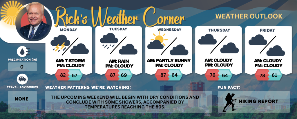
The upcoming weekend will begin with dry conditions and conclude with some showers, accompanied by temperatures reaching the 80s.
Get Out!
Take a Hike: Summits above 4,000 feet: Summits obscured. Scattered showers and thunderstorms in the afternoon. Some thunderstorms may produce gusty winds and heavy rainfall in the afternoon. Highs in the mid 70s… except in the upper 60s at elevations above 5000 feet. Southwest winds 10 to 20 mph with gusts up to 45 mph. Chance of rain 50 percent. Elevations between 2,500 and 4,000 feet: Summits will be obscured in the morning, transitioning to periods of summits emerging and receding into clouds. Scattered showers are expected, with thunderstorms developing in the afternoon. Some thunderstorms may bring gusty winds and heavy rainfall during the afternoon. Temperatures will reach highs in the upper 70s. Southwest winds will range from 10 to 15 mph’s up to 30 mph. The chance of rain50 percent.h
Hit the Beach Hampton & Rye Beach
- Weather: Mostly sunny. Isolated showers.
- UV Index: Very high.
- Thunderstorm Potential: None.
- High Temperature: In the upper 80s.
- Winds: Southwest winds around 10 mph.
- Surf Height: Around 2 feet.
- Water Temperature: 63 degrees.
- Rip Tide Current Risk: Low.
- Tides Hampton Beach: High 7.1 feet (MLLW) 09:53 AM. Low 1.8 feet (MLLW) 03:57 PM.
SATURDAY: Surf height around 2 feet. Partly sunny. Highs in the upper 70s. Southwest winds around 5 mph.
SUNDAY: Surf height around 2 feet. Mostly sunny. Highs in the upper 80s. Southwest winds around 10 mph.
Jump in a Lake Weirs Beach: Southwest winds 5 to 10 mph. Waves around 2 feet. Mostly sunny. Scattered showers and thunderstorms in the afternoon. Some thunderstorms may produce gusty winds and heavy rainfall in the afternoon. Humid with highs in the upper 80s. Chance of rain 30 percent. Water temperature 69 degrees.