Snow closing in for Thursday featuring wind and arctic chill
read more…: Snow closing in for Thursday featuring wind and arctic chillA coastal winter storm is on the move, arriving Thursday and bringing blizzard conditions.

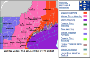
A coastal winter storm is on the move, arriving Thursday and bringing blizzard conditions.

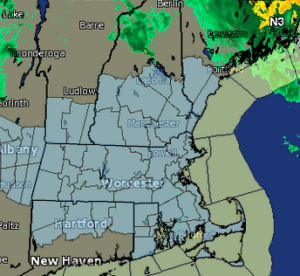
The National Weather Service has issued a Winter Storm Watch in advance of a “major coastal storm” possible Thursday and Thursday Night.

Don’t be fooled by the daffodils. A cold winter wind is about to blow in colder temperatures and even some snow.

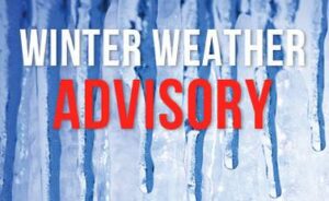
The National Weather Service in Gray, Maine, has issued a Winter Weather Advisory for mixed precipitation. Good news: School vacation week means you don’t have to get up early to check for a delay. However, the bad news is that travel advisories have been issued for those of us not on vacation.

Snow has dissolved into rain as temperatures Saturday are expected to creep up into the “this is winter?” zone.
Go back to bed, if you can.
So far, it sounds like this storm is tracking far enough south of New Hampshire that we can let the milk cartons get dangerously low and eat the last of the bread in the bread box, if we want to.

An arctic cold front is moving in setting the stage for a deep freeze and weekend snow, according to the National Weather Service.
A Winter Weather Advisory remains in effect until 4 p.m. Saturday.
Just when you thought your lawn was going to make an extended appearance this week, the National Weather Service has issued a Winter Weather Advisory for Jan. 12, between 3 p.m. and 1 a.m. Wednesday.

A flood watch is in place for areas of New Hampshire for Sunday.
Our Winter Weather Watcher sees some frigid temperatures on the horizon. Not only will temperatures dip into the single digits by Monday morning, but a persistent wind chill will keep the air temperature dangerously cold throughout the day.
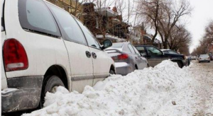
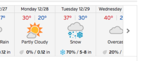
A snow emergency will be in effect Dec. 29 from 10 p.m. until 6 a.m. Dec. 30. Snow Emergency means any vehicle parked on the streets will be towed and impounded.

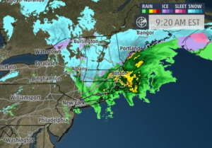
Sleet is falling as of 6:30 a.m. in the Queen City, where early-morning commuters will have to deal with some unplowed side roads and sloppy conditions.
A look at the current weather map makes it easier to get over our lack of the white stuff on Christmas. How about a white Monday night into Tuesday?
Keep your umbrella handy as you wrap up your Christmas shopping. You can leave your winter coat hanging, along with your stockings, by the fireplace. Won’t be needing it.

The weather outside is not frightful, but snow was faintly falling. We’ve got the footage.
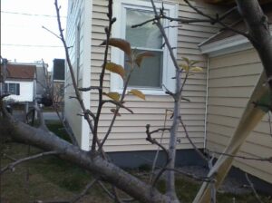
If you’ve noticed your spring bulbs prematurely pushing up through the mulch, or your forsythia bush about to explode with yellow blooms, then you are probably worried – like the experts are – about the run of warm weather, and the bigger picture.
A Wind Advisory remains in effect from 11 a.m. Tuesday to 6 p.m. according to the National Weather Service.

If you blinked, maybe you missed it, but as I gazed out my back window at approximately 12: 46 p.m. Oct. 18 I saw white flakes floating through the air.