
Weather Watch with Rick Gordon
Below: Watch your weather outlook via YouTube, delivered in two minutes.
Sunday’s Weather
Weather Alerts
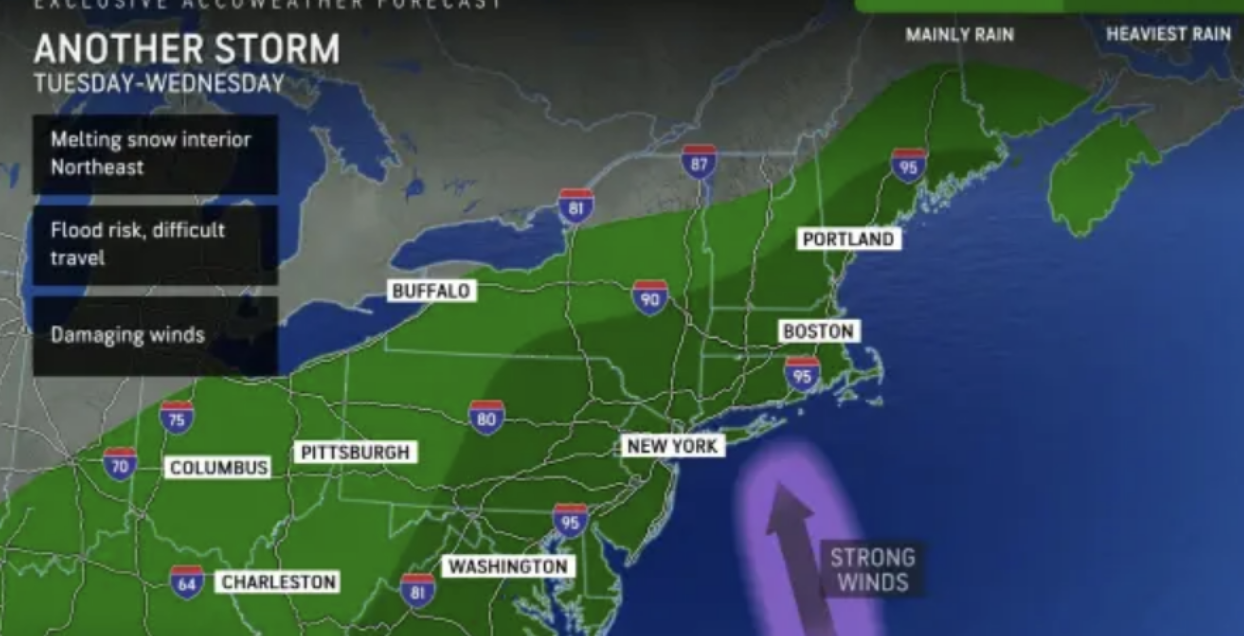
Rain Tuesday night into Wednesday will likely bring a rapid melting of the existing snow cover on the ground beneath that is still wet from prior storms in December. Flooding of city streets, small streams, and even along some major rivers is likely. In addition to the likelihood of heavy rain and flooding is the risk of damaging winds and power outages with winds gusting over 40 mph. Property owners and road crews may be able to help with flood control by keeping storm drains free from piles of snow during storm cleanup operations.
Winter Storm Warning
5-Day Outlook, Jan. 7-11

Weather Patterns We’re Watching
 Hiking Report/White Mountains Weather
Elevations for summits above 4,000 feet in Northern New Hampshire Today: Summits obscured. Snow (2-4″). Highs around 13. East winds 10 to 20 mph with gusts up to 35 mph. The chance of snow is 90 percent.
Elevations between 2,500 and 4,000 feet in Northern New Hampshire Today: Summits obscured. Snow (2-4″). Highs around 15. East winds 10 to 15 mph with gusts up to 30 mph. The chance of snow 90 percent.

Check for opening dates for Ski NH resorts.