
Rick Gordon’s Weather Watch
Follow our YouTube channel here.
Today’s Weather
The sun is shining, and the day is lovely! With temperatures reaching a comfortable high 81 degrees and a gentle breeze coming in from the east-southeast at 5 to 10 mph, it’s the perfect time to enjoy the outdoors.
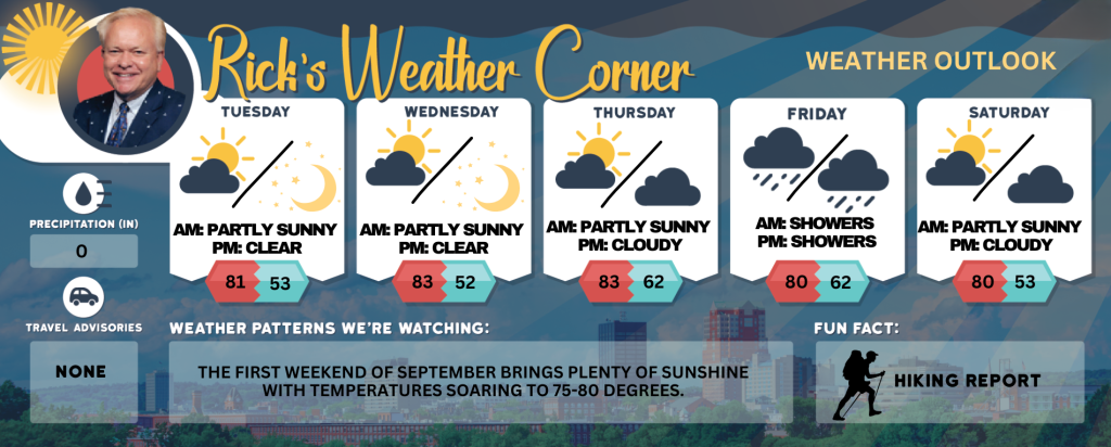
Today: Some sun & pleasant. High 81 Winds: ESE 5-10 mph
Tonight: Clear to partly cloudy & cool. Low 53 Winds: S 5-10 mph
Wednesday: Mostly sunny & warm. High 83 Winds: SSW 5-10 mph
Wednesday night: Clear & cool. Low 52 Winds: Light & Variable
Thursday: Mainly sunny, breezy, and warm. High 83 Winds: S 10-15+ mph
Thursday night: Clouding up. Low 62 Winds: S 5-10 mph
Friday: Mostly cloudy and humid with a couple of showers (.15″) with scattered thunderstorms developing later in the day; the rain is much needed due to recent dry conditions. High 80 Winds: SSW 10-15 mph
Friday night: Mainly cloudy & humid with a few showers late. Low 64 Winds: S 5-10 mph
Saturday: Humid with some sun & clouds. High 80 Winds: SW 10-15 mph
Saturday night: Partly cloudy and less humid. Low 53 Winds: WNW 5-10 mph
Atlantic Hurricane Season Approaches
Tropical activity is expected to intensify as the peak of the Atlantic hurricane season approaches. September marks the peak of hurricane season in the Atlantic, and there’s a possibility that Tropical Storm Gabrielle could develop before the weekend or early next week. As a result, an increase in tropical activity is anticipated within a week, perfectly aligning with the peak of the Atlantic hurricane season on September 10.
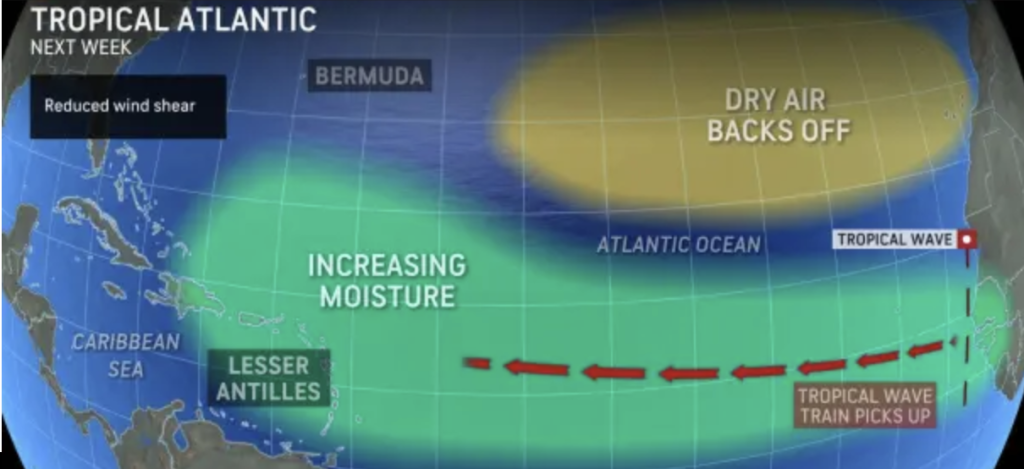
During this period, more tropical waves are expected to emerge from the western coast of Africa. With reduced dust and dry air, it’s likely that more of these waves will intensify.
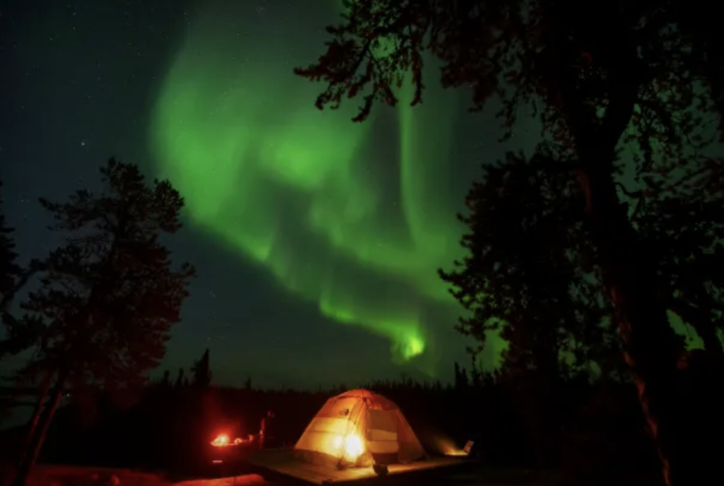
One of the best chances since spring to spot the Aurora Borealis will unfold Monday night across Canada and parts of the US. An eruption on the sun over the weekend blasted charged particles into space, and they are on a collision course with Earth. When the charged particles reach the planet, it will set off a colorful display of the Aurora Borealis. People as far south as Pennsylvania, Indiana, Nebraska and Oregon could see the green or red glow of the aurora in the sky on tonight.
Weather Patterns We’re Watching
The first weekend of September brings plenty of sunshine with temperatures soaring to 75-80 degrees.
Get Out!
Take a Hike: Take a Hike: Summits above 4,000 feet: Summits alternately shrouded in clouds. Temperatures reaching the lower 60s, dropping to the mid-50s at elevations above 5000 feet. Winds light and variable. Elevations between 2,500 and 4,000 feet: Mostly cloudy skies with highs reaching the upper 60s. Light and variable winds throughout the day.
Hit the Beach Hampton & Rye Beach Weather: There’s no thunderstorm potential today. The high temperature will be in the lower 70s, with light and variable winds shifting to the east at around 5 mph in the afternoon. Surf height will start at about 1 foot and build to around 2 feet later in the day. Rip current risk is low. The ocean temperature is 62 degrees. Tides at Hampton Beach include a high of 6.7 feet (MLLW) at 7:38 AM and a low of 2.1 feet (MLLW) at 1:40 PM.