Rick Gordon’s Weather Watch
Follow our YouTube channel here.
Weather Watch
The cold air settling in after our latest storm means we won’t see much, if any, natural melting for days. The next time temperatures climb above freezing will be next Monday, Groundhog Day, with a high of 34 degrees. The chilliest stretch of the week will likely be tonight and Wednesday night into Thursday morning, with lows dipping close to zero.

SUNDAY SNOW TOTALS
Snow totals from Sunday’s storm do not include Monday’s snowfall.
Belknap County:
- Meredith 8″
- Barnstead 7″
- Sanbornton 5.5″
Carroll County:
- Freedom 6.2″
- Albany 2″
Cheshire County:
- Jaffrey 14.1″
- Roxbury 9.3″
- Spofford 7.3″
Grafton County:
- Plymouth 6.9″
- Bristol 6.7″
Hillsborough County:
- Greenville 14″
- New Boston 13″
- New Ipswich 12.5″
- Merrimack 11.3″
- Bedford 11″
- Brookline 10.9″
- Hollis 8.3″
- Nashua 10″
- Hudson 9.7″
- Manchester Airport 9.2″
- Peterborough 9″
- Hooksett 8.5″
- Francestown 8.4″
- Hollis 8.3″
- Bennington 7.8″
- Hillsborough 5.8″
Rockingham County:
- Salem 20″
- Rye 18″
- Newton 16″
- Plaistow 14″
- Derry 12″
- Exeter 12″
- Seabrook 12″
- Hampstead 11.5″
- Stratham 11.5″
- Deerfield 11″
- Atkinson 10.5″
- Newton 10″
- Fremont 8″
- Windam 8″
- Londonderry 7.5″
- Chester 6.2″
Strafford County:
- Dover 13″
- Durham 12.8″
- Somersworth 9.5″
- Rochester 9″
- Rollinsford 7.2″
- Dover 7″
- Strafford 7″
- Northwood 6.2″
Sullivan County:
- Sunapee 9.2″
- Newport 8.5″
- Claremont 7″
- Springfield 4.5″
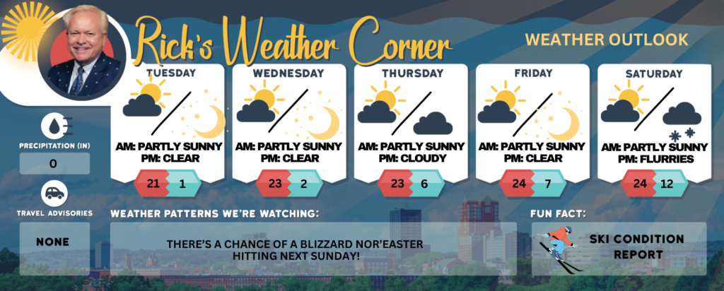
Today: Cold with some sun & clouds. High 21 (feel like 11) Winds: W 5-10 mph
Tonight: Clear to partly cloudy & frigid. Low 1 (feel like -7) Winds: WSW 5-10 mph
Wednesday: Cold with some sun & clouds. High 23 (feel like 11) Winds: WNW 10-15+ mph
Wednesday night: Mainly clear & frigid. Low 2 (feel like -6) Winds: WNW 5-10 mph
Thursday: Cold with some sun & clouds. High 23 (feel like 15) Winds: NW 10-15 mph
Thursday night: Some clouds, breezy, and very cold. Low 6 (feel like -5) Winds: NW 10-15 mph
Friday: Mainly sunny, breezy, and cold. High 24 (feel like 5) Winds: NW 10-15 mph
Friday night: Clear to partly cloudy and very cold. Low 7 (feel like -13) Winds: NW 10-15 mph
Saturday: Cold with a mix of sun & clouds. High 24 (feel like 14) Winds: NW 5-10 mph
Saturday night: Watching a potential winter storm with snow showers after midnight. Low 12 (feel like 2) Winds: N 5-15 mph
Weather Patterns We’re Watching
There’s a chance of a blizzard nor’easter hitting next Sunday!
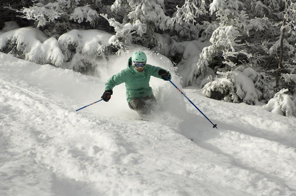
Get Out!
Elevations for summits above 4,000 feet in Northern New Hampshire today: Summits will be hidden in clouds, with highs near 4°F, dropping to around -2°F above 5,000 feet. Northwest winds around 35 mph will shift to the west at about 20 mph in the afternoon, with gusts reaching up to 75 mph. Wind chills could plunge as low as -49°F.
Elevations between 2,500 and 4,000 feet in Northern New Hampshire today: Summits hidden in clouds, with highs near 6 above. West winds blowing at 10 to 20 mph, gusting up to 55 mph.