
Tuesday’s Weather
Today lots of sun with a gusty westerly wind with highs near 60.

5-Day Outlook Nov. 2 – Nov. 6
Today: Some sun & clouds High 54 Winds: WSW 5-10 mph
Tonight: Partly cloudy Low 35 Winds: Light & Variable
Wednesday: Mostly sunny High 53 Winds: WNW 5-10 mph
Wednesday night: Clear & cold with a frost and freeze Low 28 Winds: Light & Variable
Thursday: Cold with a mix of sun & clouds High 49 Winds: Light & Variable
Thursday night: Partly cloudy & cold Low 32 Winds: Light & Variable
Friday: Mostly sunny & cold High 49 Winds: Light & Variable
Friday night: Clear & cold Low 30 Winds: Light & Variable
Saturday: Some sun & clouds High 51 Winds: NNW 5-10 mph
Saturday night: (Put clocks back 1 hour) Mostly clear & cold Low 34 Winds: Light & Variable
Weather Patterns We’re Watching
Our coldest week of fall so far continues into the weekend.
Average Annual Snowfall
(1991-2020 Normal Snowfall) New Hampshire, normal snowfall averages from 50 to 75” along the coast, but gradually increases as you move inland to more than 200” in the mountains. The lesser amounts in coastal areas are partly a result of a frequent change-over to sleet, freezing rain or rain during well-developed winter storms.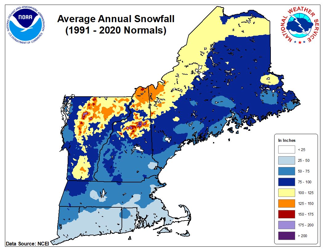
Forecast for the White Mountains
- Summits above 4,000 feet in Northern New Hampshire. Today: Summits obscured. Highs in the mid-30s…except around 30 at elevations above 5000 feet. West winds 30 to 40 mph…except west 45 to 55 mph at elevations above 5000 feet. Wind chill values as low as 1 below in the morning.
- Elevations between 2,500 and 4,000 feet in Northern New Hampshire. Today: Cloudy. Highs around 40. West winds 30 to 40 mph. Wind chill values as low as 16.

Be an official Ink Link Weather Spotter!
Rick Gordon could use your help. If you are interested in becoming a local weather spotter (all locations around NH) contact Rick at gordonwx@comcast.net and he’ll walk you through the process!