
Weather Watch Video
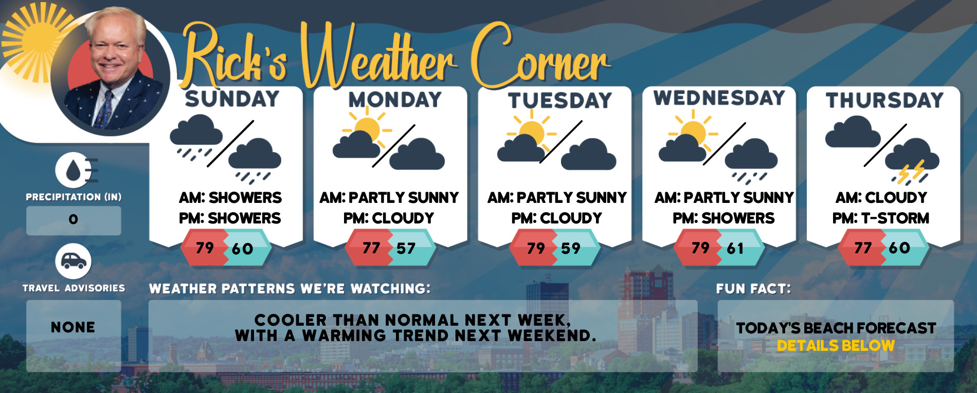
Tuesday’s Weather
Today will be breezy and colder with some sun & clouds. The real story will be the late week cold snap, the coldest air of the season, and maybe since 2016 arrives in the Granite State.
Weather Alert
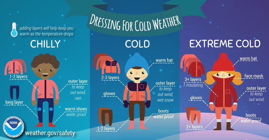
The coldest air of the winter moves in towards the end of the week. Start considering the potential for extremely cold conditions! Confidence is increasing for dangerous cold across New Hampshire on Friday night and Saturday morning. Wind chills will fall below zero sometime Friday night and not recover back above zero until sometime Sunday afternoon. Here are tips for dressing for extreme cold.
Daily Forecast for Jan. 31, 2022-Feb.4, 2023
Weather Patterns We’re Watching
The coldest air of the winter moving in as we start the first weekend of February. The first Saturday of February will be frigid, starting out at -13 with the afternoon high at only 6 but feels like -13.

Click for New Hampshire Ski & Boarding Report
White Mountains Weather
The forecast for summits above 4,000 feet in Northern New Hampshire:
Today – Summits obscured in the morning, then clearing. Highs around 8 above. Northwest winds 25 to 35 mph… except northwest 40 to 50 mph at elevations above 5,000 feet. Wind chill values are as low as 42 below.
The forecast for elevations between 2,500 and 4,000 feet in Northern New Hampshire:
Today – Summits in and out of clouds in the morning then becomes mostly cloudy. Highs around 11. Northwest winds 25 to 35 mph with gusts up to 55 mph. Wind chill values as low as 30 below.