
Weather Watch with Rick Gordon
Below: Watch your weather outlook via YouTube, delivered in two minutes.
Tuesday’s Weather
Today the morning will remain dry, our attention is on an approaching cold front this afternoon that will increase shower, downpour, and perhaps thunderstorm chances after 2 PM. Any thunderstorm can cause flash flooding.
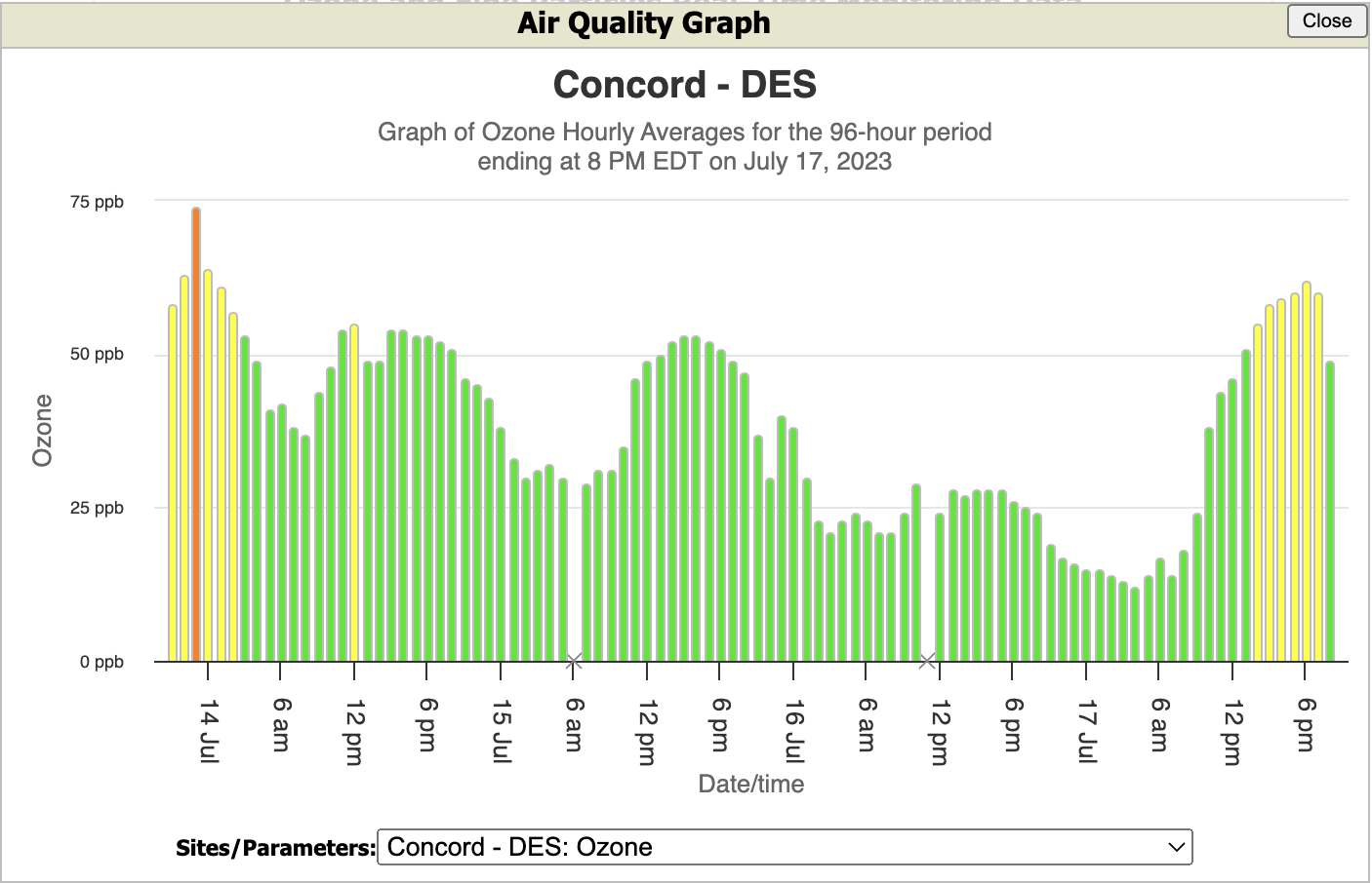
AIR QUALITY ALERT IN EFFECT UNTIL MIDNIGHT TONIGHT

Preliminary 2-day rainfall totals
Sunday Manchester set a record of 2.50″ breaking the old record of 1.30″ set in 1961. We got a break yesterday; we are expecting more thunderstorms late this afternoon and evening. 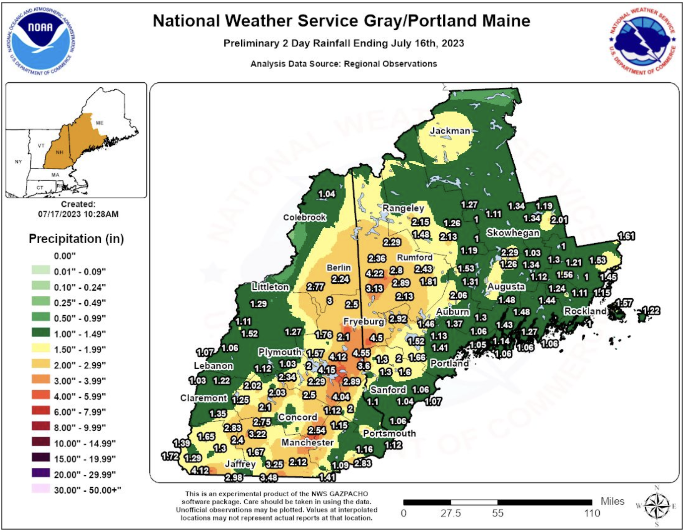
Weather Patterns We’re Watching
Next week is mainly dry & humid with highs in the mid-upper 80s.
 Hiking Report/White Mountains Weather
Elevations for summits above 4,000 feet in Northern New Hampshire Today: Summits obscured. A chance of showers in the morning then showers with a chance of thunderstorms in the afternoon. Highs in the upper 60s. South winds 15 to 25 mph. Chance of rain 90 percent.
Elevations between 2,500 and 4,000 feet in Northern New Hampshire Today: Summits obscured. A chance of showers in the morning then showers with a chance of thunderstorms in the afternoon. Highs in the lower 70s. South winds 10 to 15 mph with gusts up to 25 mph. Chance of rain 90 percent.

BEACH FORECAST
Weather: Humid with clouds and sun; a thunderstorm late in the afternoon; smoke from distant wildfires can cause poor air quality
UV Index: Very high.
Thunderstorm Potential: Moderate. Implies that thunderstorms are possible.
High Temperature: In the upper 70s.
Winds: South winds 5 to 10 mph.
Surf Height: Around 3 feet.
Water Temperature: 67.
Rip Current Risk: Low.
Tides Hampton Beach: Low 0.1 feet (MLLW) 07:02 AM. High 7.8 feet (MLLW) 12:56 PM.
 View on Lake Winnipiseogee (1828) by American painter Thomas Cole