Rick Gordon’s Weather Watch
Follow our YouTube channel here.
Today’s Weather
Mostly sunny skies characterize today’s weather, but it will be windy and quite cold. The high temperature will reach 23 degrees, although it may feel as chilly as 9 degrees due to the wind chill. Expect west winds ranging from 10 to over 20 mph, so it’s advisable to dress in layers to stay warm.
Polar Vortex Returns
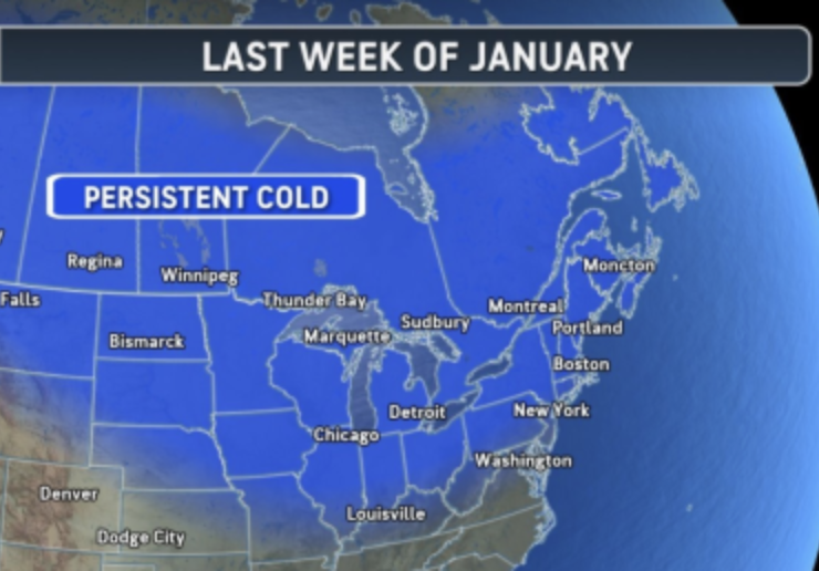
Brace yourselves, everyone! The polar vortex is making its grand return!
🌨️❄️ A polar vortex will bring much colder air to New England through the end of January. Colder air is making its way back to New England as the polar vortex stirs up, bringing swings in temperatures, occasional snow, and the chance of a more intense cold snap later this month. Colder air is settling back into the central and eastern United States after a brief warm spell. Over the next 10 to 14 days, the polar vortex will stay active, with cold air likely to dominate the weather through the end of the month and into early February. The last week of this month will see high temperatures in the teens, with lows dipping into the single digits or even below zero.
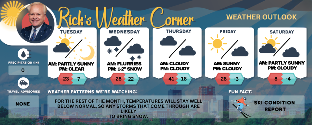
Today: Windy, very cold with sunshine and a few clouds. High 23 (feel like 9) Winds: W 15-20+ mph
Tonight: Mainly clear & frigid. Low 7 (feel like 2) Winds: WSW 5-10 mph
Wednesday: Some morning sun with afternoon clouds with flurries by evening. High 28 (feel like 13) Winds: SSW 5-10 mph
Wednesday night: Some snow (1-2″) and flurries. Low 22 (feel like 14) Winds: SSW 5-10 mph
Thursday: Some partial sunshine not as cold. High 41 (feel like 34) Winds: WSW 10-15 mph
Thursday night: Some clouds and cold. Low 18 (feel like 12) Winds: WNW 5-15 mph
Friday: Some sunshine and very cold. High 28 (feel like 18) Winds: W 10-15 mph
Friday night: Partly cloudy, breezy, and frigid. Low -3 (feel like -15) Winds: W 10-15 mph
Saturday: Breezy and frigid with some sun & clouds. High 8 (feel like -10) Winds: NW 10-15+ mph
Saturday night: Partly to mostly cloudy, breezy, and frigid. Low -4 (feel like -16) Winds: NNSW 10-15+ mph
Weather Patterns We’re Watching
For the rest of the month, temperatures will stay well below normal, so any storms that come through are likely to bring snow.
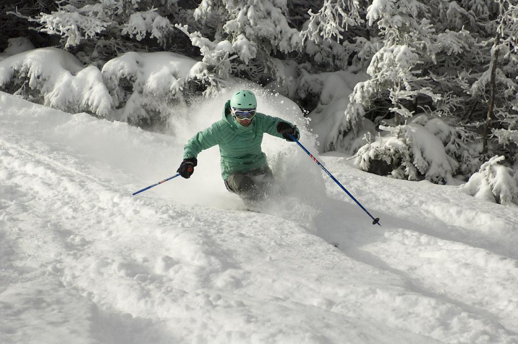
Get Out!
Elevations for summits above 4,000 feet in Northern New Hampshire today: Summits are hidden, with temperatures ranging from 2 below to 8 above zero. West winds will blow at 25 to 35 mph, increasing to 40 to 50 mph at elevations over 5,000 feet. Wind chills could plunge to 49 below.
Elevations between 2,500 and 4,000 feet in Northern New Hampshire today: Summits drifting in and out of the clouds, with highs near 7 above. West winds blowing at 15 to 25 mph, gusting up to 60 mph. Wind chill could drop to as low as 30 below.