Rick Gordon’s Weather Watch
Follow our YouTube channel here.
Today’s Weather
Get ready for a delightful day! The morning will be filled with bright sunshine, with afternoon clouds moving in. Expect a high of 26 degrees—though it may feel like 15—perfect for enjoying the outdoors. With a gentle breeze from the south-southwest at 5 to 10 mph, it’s an ideal day to soak in the beauty around you as long as you bundle up.
Polar Vortex Returns
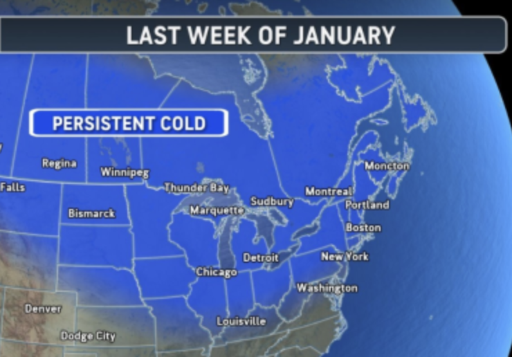
Brace yourselves, everyone! The polar vortex is making its grand return!
🌨️❄️ A polar vortex will bring much colder air to New England through the end of January. Colder air is making its way back to New England as the polar vortex stirs up, bringing swings in temperatures, occasional snow, and the chance of a more intense cold snap later this month. Colder air is settling back into the central and eastern United States after a brief warm spell. Over the next 10 to 14 days, the polar vortex will stay active, with cold air likely to dominate the weather through the end of the month and into early February. The last week of this month will see high temperatures in the teens, with lows dipping into the single digits or even below zero.
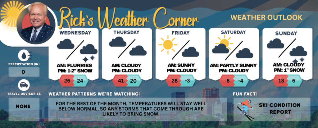
Today: Morning sun with afternoon clouds. High 26 (feel like 15) Winds: SSW 5-10 mph
Tonight: Some snow (1-2″) and flurries. Low 24 (feel like 15) Winds: SSW 5-10 mph
Thursday: Some partial sunshine, breezy, and not as cold. High 41 (feel like 32) Winds: WSW 10-15+ mph
Thursday night: Some clouds and cold. Low 20 (feel like 14) Winds: W 5-10 mph
Friday: Some sunshine, breezy, and colder. High 28 (feel like 17) Winds: W 10-15+ mph
Friday night: Cold weather alert: Partly cloudy, breezy, and frigid. Low -3 (feel like -15) Winds: W 10-15 mph
Saturday: Breezy and brutally cold with lots of sunshine. High 8 (feel like -10) (record low high 9 set in 2011) Winds: NW 10-15+ mph
Saturday night: Cold weather alert: Partly to mostly cloudy and frigid. Low -4 (feel like -16) Winds: NW 5-10 mph
Sunday: Mostly cloudy and frigid. High 13 (feel like 9) Winds: NNW 5-10 mph
Sunday night: Some snow showers (1″) or flurries. Low 6 Winds: Light & Variable
Weather Patterns We’re Watching
For the rest of the month, temperatures will stay well below normal, so any storms that come through are likely to bring snow.
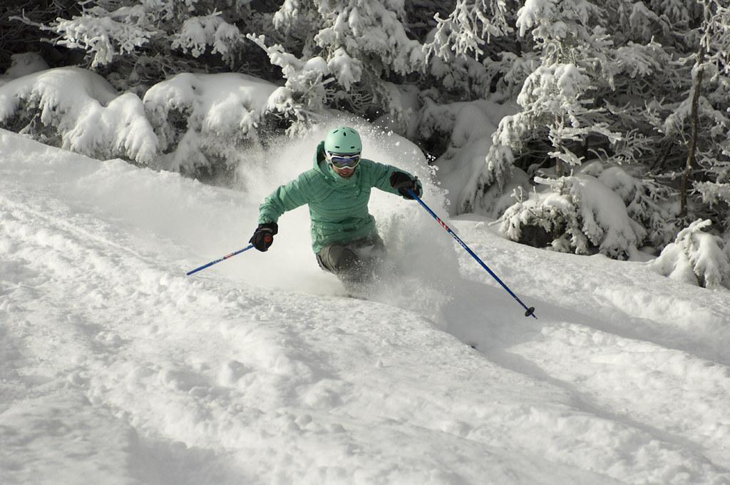
Get Out!
Elevations for summits above 4,000 feet in Northern New Hampshire today: Summits will be obscured, with a chance of snow in the afternoon. Highs will be near 14, with southwest winds of 10 to 20 mph, increasing to 25 to 35 mph above 5000 feet. There’s a 40 percent chance of snow, and wind chills could drop as low as 47 below.
Elevations between 2,500 and 4,000 feet in Northern New Hampshire today: Mostly cloudy in the morning, with summits becoming obscured later on. Snow is possible in the afternoon, with highs near 15. Southwest winds will blow at 10 to 15 mph, gusting up to 40 mph, and there’s a 40 percent chance of snow.