
Rick Gordon’s Weather Watch
Follow our YouTube channel here.
Today’s Outlook
Get ready for a delightful day! You’ll be greeted by warm morning sunshine, but as the afternoon rolls in, expect some clouds to float by. A refreshing breeze will keep things comfortable, and as we approach evening, don’t forget to grab your umbrella – showers are on the way! Highs will reach a pleasant 73°F, with winds coming from the northwest at 10-15+ mph. Enjoy the changing skies!Get ready for a delightful day! You’ll be greeted by warm morning sunshine, but as the afternoon rolls in, expect some clouds to float by. A refreshing breeze will keep things comfortable, and as we approach evening, don’t forget to grab your umbrella – showers are on the way! Highs will reach a pleasant 73°F, with winds coming from the northwest at 10-15+ mph. Enjoy the changing skies!
The Last Weekend of May
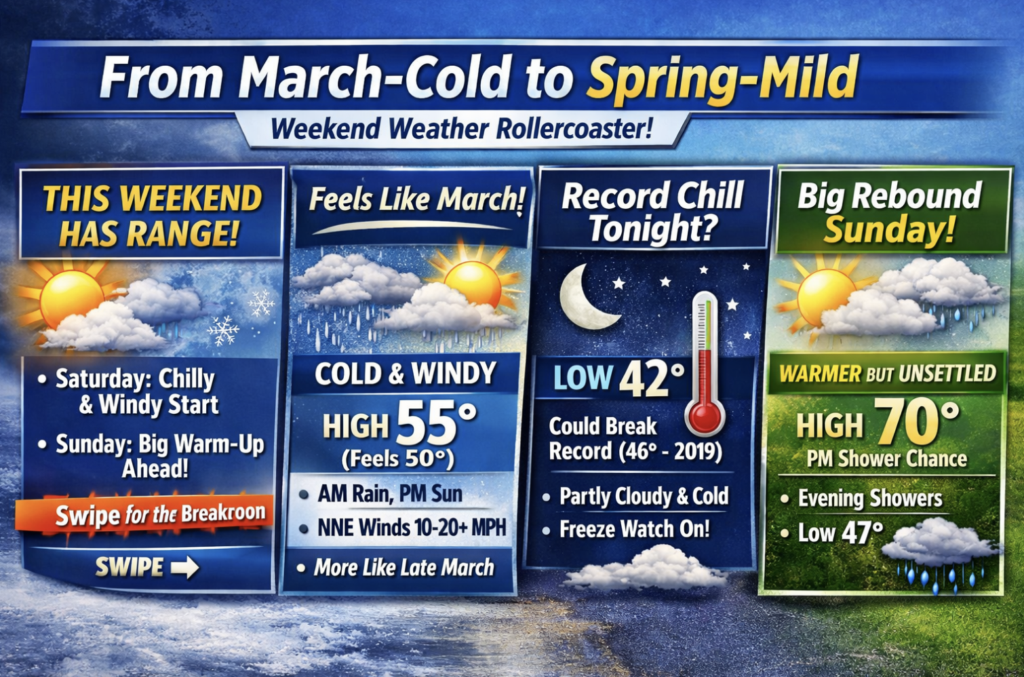
After a midweek surge of summer-like temperatures in New England, more chill and even snowflakes are expected this weekend!
Temperatures reminiscent of July will be followed by a sharp cooldown, bringing showers, gusty winds, and potentially wet snow to some of the higher peaks in the White Mountains this weekend.
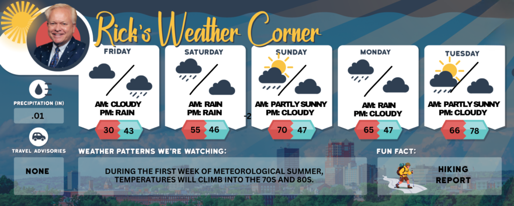
Friday: Some morning sun with afternoon clouds, breezy, with showers by evening. High 73 Winds: NW 10-15+ mph
Friday night: Periods of rain (.50″) and breezy. Low 43 Winds: SE 10-20 mph
Saturday: Colder & windy; Rain ending early (.15″) followed by some afternoon sunshine; feeling more like late March instead of the last weekend of May. High 55 (feel like 50) Winds: NNE 10-20+ mph
Saturday night: Partly cloudy and chilly with the temperature breaking the record low of 46 set in 2019. Low 42 Winds: NNW 5-10 mph
Sunday: Some morning sun with afternoon clouds with a passing afternoon shower. High 70 Winds: NW 5-15 mph
Sunday night: Evening showers, followed by partly cloudy late & chilly. Low 47 Winds: Light & Variable
Monday (June 1st, Start of Meteorological Summer.): Early sun followed by clouds & cool with afternoon showers. High 65 Winds: N 5-15 mph
Tuesday: Some early morning sun & cool. A few showers developing later in the day. High 66F. Winds N at 5 to 10 mph
Tuesday night: Partly cloudy & chill
Weather Patterns We’re Watching
During the first week of meteorological summer, temperatures will climb into the 70s and 80s.
Get Out!
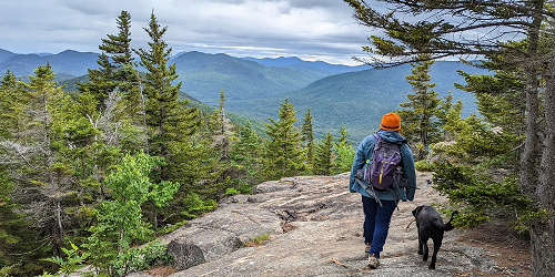
Take a HikE
Elevations for summits above 4,000 feet in Northern New Hampshire. Today: Summits will be obscured with scattered rain showers expected in the morning. Rain is likely in the afternoon, with high temperatures around 50 degrees, except in the lower 40s at elevations above 5,000 feet. Northwest winds will be around 30 mph, shifting to about 20 mph from the west in the afternoon, with gusts reaching up to 55 mph. There is a 70 percent chance of rain, and wind chill values may drop as low as 19 degrees.
Elevations between 2,500 and 4,000 feet in Northern New Hampshire. Today: Summits will be obscured with rain likely in the afternoon. High temperatures will reach the lower 50s. Northwest winds will blow at 10 to 15 mph, with gusts up to 45 mph. The chance of rain is 70 percent.