Rick Gordon’s Weather Watch
Follow our YouTube channel here.
Today’s Weather
Cooler temperatures in the morning with afternoon clouds and light precipitation, including some snow and rain late in the day. High of 41 degrees (feels like 33) with southwest winds at 10-15 mph.
Weekend Snapshot
🌬️ Saturday High 45° but feels like the low 30s thanks to strong W winds 20–30+ mph Mix of sun and clouds, very blustery and chilly The kind of day where the wind does most of the talking
❄️ Saturday Night Low 24°, feeling closer to the upper teens WNW winds 10–20 mph keep it breezy and cold Partly cloudy and sharply chilly
☁️ Sunday High 38°, feeling mid‑30s Mostly cloudy and chilly with a lighter NE breeze 5–15 mph A quieter day overall before changes arrive at night
🌧️ Sunday Night Low 34°, feeling upper 20s Clouds thicken with rain developing late (~0.25″) ESE winds 5–10 mph, a damp and raw finish to the weekend
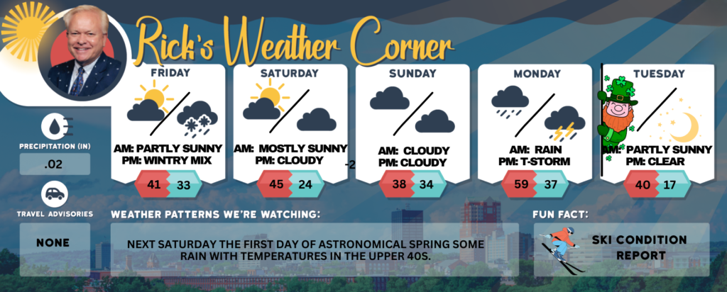
Friday: Cooler with morning sun and afternoon clouds with a little accumulation of snow and rain late in the afternoon. High 41 (feel like 33) Winds: SW 10-15 mph
Friday night: A little evening snow (trace-.5″) with some clearing late. Low 33 (feel like 27) Winds: S 5-10 mph
Saturday: Strong chilly winds; times of clouds and sun. High 45 (feel like 33) Winds: W 20-30+ mph
Saturday night: Partly cloudy, breezy, & cold. Low 24 (feel like 18) Winds: WNW 10-20 mph
Sunday: Cloudy & chilly. High 38 (feel like 36) Winds: NE 5-15 mph
Sunday night: Cloudy with rain (.25″) late. Low 34 (feel like 28) Winds: ESE 5-10 mph
Monday: Milder & breezy with periods of rain (.70″). High 59 (feel like 49) Winds: SE 10-20 mph
Monday night: Evening rain & a possible thunderstorm. Low 37 (feel like34) Winds: WSW 10-15 mph
Saint Patrick’s Day: Cold & breezy with clouds giving way to some sun later in the day. High 40 (feel like 31) Winds: W 15-20 mph
Tuesday night: Mainly clear & cold. Low 17 (feel like 9) Winds: WNW 10-15 mph
Weather Patterns We’re Watching
Next Saturday the first day of Astronomical Spring some rain with temperatures in the upper 40s.
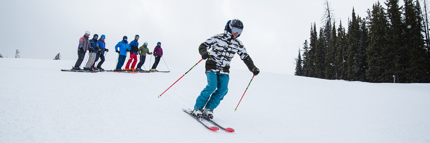
Get Out!
Elevations for summits above 4,000 feet in Northern New Hampshire today: The mountain summits will be hidden, with a chance of snow in the afternoon. Temperatures will reach the mid-20s, with west winds around 25 mph shifting to the south later in the day. Above 5000 feet, winds will blow from the west at about 45 mph before easing to 35 mph from the south in the afternoon, with gusts reaching up to 75 mph. There’s a 50 percent chance of snow, and wind chills could drop as low as 28 below.
Elevations between 2,500 and 4,000 feet in Northern New Hampshire today: It’ll be cloudy with a chance of snow in the afternoon. Highs will be in the upper 20s, with west winds around 20 mph shifting to the south later in the day. Gusts could reach up to 50 mph, and there’s a 50 percent chance of snow.