Rick Gordon’s Weather Watch
Follow our YouTube channel here.
Today’s Weather
Get ready for a pleasant day ahead! Enjoy a delightful blend of sun and clouds, with temperatures reaching a comfortable high of 43°. Although it might feel a touch cooler at 36°, a refreshing southwest breeze at 10-15 mph will add to the charm. Don’t miss out on this lovely weather – make the most of it!
The Chill Before the Warm
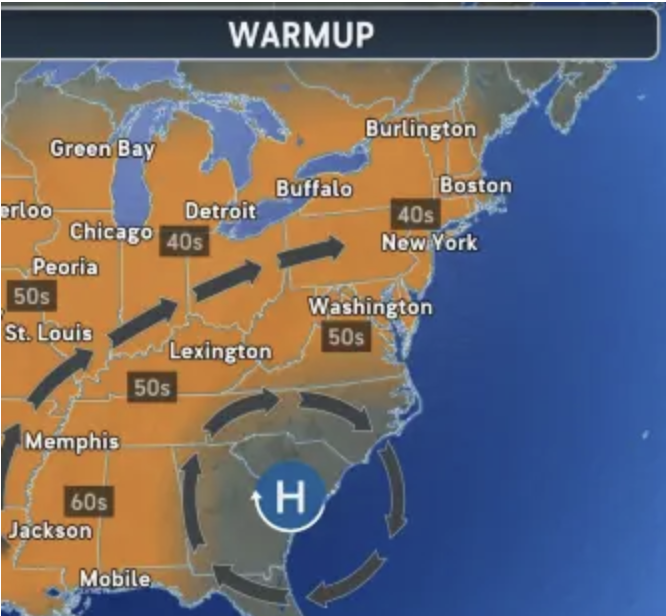
A break from the deep freeze is coming as it will be warmer later this week. How long will the break last, and could it ruin the chances of having a white Christmas? The start of December is usually cold due to the polar vortex. So far this month, New England has recorded average temperatures about 10 to 15 degrees below normal.

As the week goes on, the cold will ease up, with many places seeing temperatures rise above the usual 40-degree average from Wednesday to Friday. With the warmup, it could dash the hopes for many of a white Christmas as current snow cover on the ground may melt and not survive to Christmas Day. But some long-range models are calling for some snow on Christmas Day.
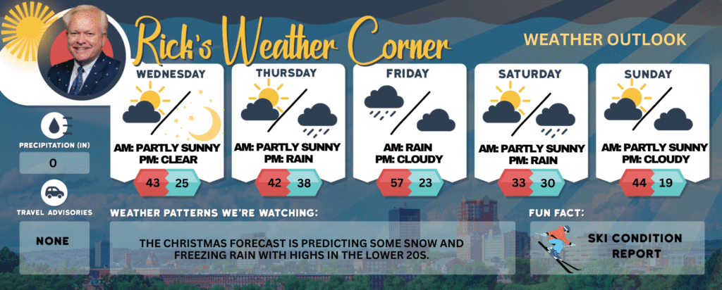
Today: Milder & breezy with some sun & clouds. High 43 (feel like 36) Winds: SW 10-15+ mph
Tonight: Clear to partly cloudy. Low 25 Winds: W 5-10 mph
Thursday: Some sun & clouds. High 42 Winds: S 5-10 mph
Thursday night: Becoming cloudy & breezy with rain late. Low 38 Winds: SSE 5-15+ mph
Friday: Very mild & windy with periods of rain (1″). High 57 Winds: SSW 15-25+ (gusts 40) mph
Friday night: Partly cloudy, breezy, & colder. Low 23 (feel like 9) Winds: WNW 10-15 mph
Saturday: Some sun, breezy, and much colder with a passing flurry. High 33 (feel like 24) Winds: W 10-15+ mph
Saturday night: Cloudy & not as cold with some shower late, beginning after temperatures rise above freezing. Low 30 Winds: S 5-10 mph
Sunday (First day of Winter): Milder & breezy with some sun & clouds. High 44 (feel like 36) Winds: W 15-20+ mph
Sunday night: Partly cloudy & cold. Low 19 (feel like 6) Winds: NW 15-20 mph
Weather Patterns We’re Watching
The Christmas forecast is predicting some snow and freezing rain with highs in the lower 20s.
Get Out!
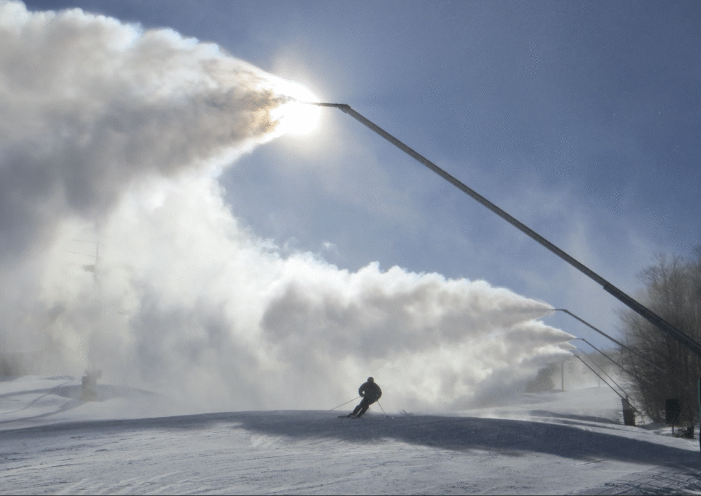
Elevations for summits above 4,000 feet in Northern New Hampshire today: Summits will drift in and out of clouds in the morning before becoming fully obscured. There’s a chance of snow showers in the afternoon, with highs in the mid-20s. West winds will blow around 40 mph, picking up to about 55 mph later in the day. Above 5,000 feet, winds will reach around 60 mph and increase to about 70 mph in the afternoon, with gusts up to 100 mph. Snow chances sit at 50 percent, and wind chills could drop as low as 9 below.
Elevations between 2,500 and 4,000 feet in Northern New Hampshire today: Summits will drift in and out of clouds in the morning before becoming fully obscured later. There’s a chance of snow showers in the afternoon, with highs near 30. West winds around 25 mph will pick up to about 35 mph later in the day, with gusts reaching up to 75 mph. Snow chances are around 50 percent, and wind chills could drop as low as 1 below in the morning.