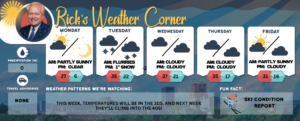

Monday’s weather: It’s Groundhog Day, sunny, blustery winds, high of 41

read more…: Monday’s weather: It’s Groundhog Day, sunny, blustery winds, high of 41

Get ready for a brisk winter day! With the sun shining and Punxsutawney Phil spotting his shadow, expect six more weeks of winter. Temperatures will top out at 31 degrees but feel closer to 19 thanks to the blustery winds. Northwest gusts of 10-15+ mph, so throw on a warm hat and enjoy the crisp, invigorating air as you head out.

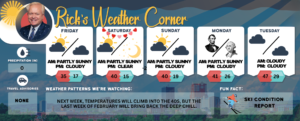
Weekend Weather: Bright, blustery + bitter-cold Friday, sunny Saturday, snow Sunday

read more…: Weekend Weather: Bright, blustery + bitter-cold Friday, sunny Saturday, snow Sunday

Get ready for a day filled with bright sunshine, but don’t be fooled by the glow! It’s going to be a blustery one, with bitterly cold temperatures. Expect a high of just 13 degrees, but it will feel more like a chilly -4 thanks to the winds coming in from the WNW at 10-20+ mph. Bundle up and enjoy the crisp winter air!

Tuesday’s weather: Cold settles in with frigid temps this week, high today of 21

read more…: Tuesday’s weather: Cold settles in with frigid temps this week, high today of 21

The cold air settling in after our latest storm means we won’t see much, if any, natural melting for days. The next time temperatures climb above freezing will be next Monday, Groundhog Day, with a high of 34 degrees. The chilliest stretch of the week will likely be tonight and Wednesday night into Thursday morning, with lows dipping close to zero.

Monday’s weather: Snow continues, along with drifting, high of 19

read more…: Monday’s weather: Snow continues, along with drifting, high of 19

The weather is expected to be cold, with intermittent light snow accumulating between 2 and 4 inches, accompanied by blowing and drifting snow. The anticipated high temperature is 19 degrees, with a wind chill that may make it feel like 9 degrees. Winds will be coming from the north at speeds of 10 to 15 miles per hour or higher.

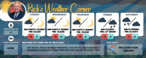
Weekend weather: Brace for major snowstorm, plunging temps

read more…: Weekend weather: Brace for major snowstorm, plunging temps

The weekend kicks off with frigid temperatures and wraps up with a winter storm watch as a major snowstorm rolls in. Brace yourselves! The winter chill is about to deepen as we brace for the season’s most intense snowstorm. Get ready for a dramatic drop in temperatures and a heavy blanket of snow like we haven’t seen yet this winter!

Wednesday’s weather: Sunny and bright, high of 26

read more…: Wednesday’s weather: Sunny and bright, high of 26

Get ready for a delightful day! The morning will be filled with bright sunshine, with afternoon clouds moving in. Expect a high of 26 degrees—though it may feel like 15—perfect for enjoying the outdoors. With a gentle breeze from the south-southwest at 5 to 10 mph, it’s an ideal day to soak in the beauty around you as long as you bundle up.

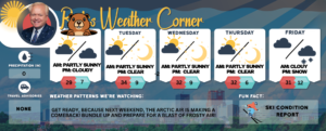
Weekend weather: Light snow Saturday, tracking Sunday storm, arctic chill Monday

read more…: Weekend weather: Light snow Saturday, tracking Sunday storm, arctic chill Monday

Winter has made its return with a brisk chill in the air! Expect temperatures to reach a high of 29°, but with the wind chill, it will feel more like 18°. Winds will be quite strong, blowing from the west at 15 to 20 mph, with occasional gusts reaching 33 mph. The sky will be a mix of sun and clouds, creating a dynamic winter atmosphere. Bundle up if you’re heading outside, as the combination of cold temperatures and blustery winds will make it feel much colder!

Thursday’s weather: Afternoon sun breaks through morning showers, high of 46

read more…: Thursday’s weather: Afternoon sun breaks through morning showers, high of 46

Start your day with an early morning rain shower, but don’t worry—the afternoon promises a break of sunshine along with a gentle breeze. Expect a high of 46 degrees, but with the wind chill, it will feel more like 40. Winds will be coming from the south-southwest at 10-15+ mph, adding a little extra crispness to the air. Embrace the changing weather and enjoy the day!

Friday’s weather: Mild day with afternoon showers, high of 45 + your weekend outlook

read more…: Friday’s weather: Mild day with afternoon showers, high of 45 + your weekend outlook

Get ready for a uniquely mild day, where clouds dominate the sky, and showers are on the horizon! As temperatures climb to a high of 45 degrees, it may feel a crisp 35, so be sure to bundle up. Expect some light afternoon showers, about a tenth of an inch of rainfall. With a gentle south wind blowing at 5 to 15 mph, it’s the perfect excuse to grab your umbrella and embrace the invigorating weather.

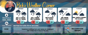
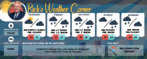
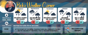
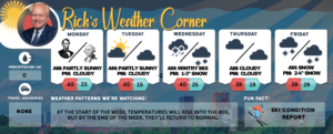
WEATHER MAP showing weekly weather forecast for Manchester NH.

Thursday’s weather: Milder temps, sunshine and fluffy clouds, high of 45

read more…: Thursday’s weather: Milder temps, sunshine and fluffy clouds, high of 45

Get ready for a delightful day as milder temperatures sweep in, bringing a blend of sunshine and fluffy clouds! With highs around 45°, it may feel a bit cooler at 43°, but don’t let that stop you—step outside and embrace the refreshing air! With a light northwest breeze at 5 to 10 mph, it’s the perfect opportunity to enjoy the beauty of the outdoors. Don’t miss out on this inviting weather!

Support Ink Link